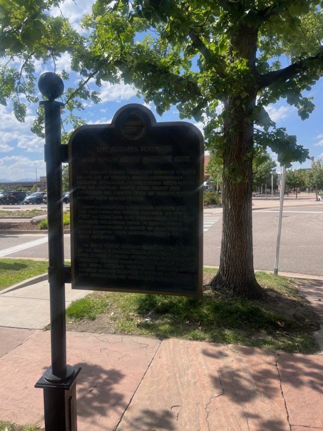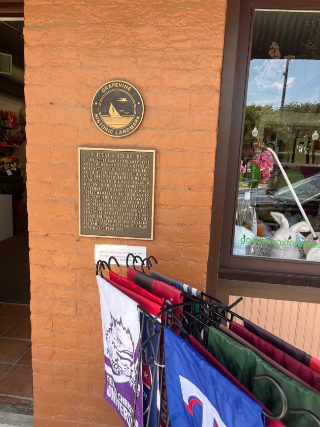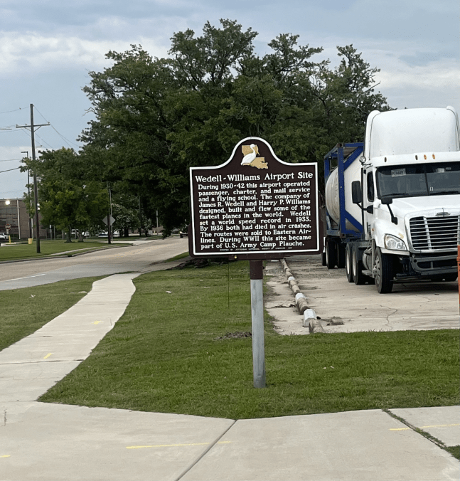
Johnny Graham and Graham’s Barber Shop Historical Marker

Johnny Graham and Graham's Barber Shop Dallas, TX

Johnny Graham was an influential Dallas barber who founded Graham’s Barber Shops and Graham’s Barber College. He opened his first barber shop in 1951. Graham would open several more barber shops across the Dallas area.

Johnny Graham was named Texas Businessman of the Year in 1969, and he was given the first Johny Graham Progressive Achievement Award from the Professional Barbers Committee (1984)

Johnny Graham died in 1990, but his legacy lives on through his employees and the students who graduated from the college. There is now a Johnny Graham Scholarship for those who want to learn how to be a barber.

Historical Marker Inscription

Texas Historical Commission

Johnny Graham and Graham’s Barber Shop

Born in Mayo, Florida, to Will and Bertha Graham, Johnny Graham (1918-1990) served in the United States Army from 1942-1945 and moved to Texas shortly after. In 1948, he began school at Fort Worth Barber College and passed the Texas State Board of Barber Examiners. Johnny cut hair in Lucy King’s Barber Shop and traveled to Kaufman on weekends to cut hair in the local barber shop. On one of these weekend trips, he met LaFrance Moody whom he married in 1949. In 1951, Johnny Graham opened his first barber shop on Southland Street in Dallas. The shop was a success and seven years later, he opened a second shop and a third in 1960. During this time, African American communities were growing with bustling business districts in many areas which often included barber shops and beauty salons. Because of this boom and his commitment to respect, fairness and courtesy, Johnn Graham’s holdings grew to include seven barber shops, a barber college (1965) and a shopping strip by 1969.

Beyond haircuts, Johnny Graham’s barber shops provided a unique space for social discussion and support. Customers could get barber service and also talk about important issues in the community. Johnny’s hard work and dedication to the profession, his employees and the community earned him several awards, including the Texas Small Businessman of the Year Award (1969) and the inaugural Johny Graham Progressive Achievement Award from the Professional Barbers Committee (1984). The barber shop donated barber services to clients in need, traveled to the St. Paul Industrial Training School near Malakoff to provide free haircuts and participated in back to school events, cementing its reputation as a significant fixture in Dallas history, business and culture.

Marker is Property of the State of Texas

2019

Location

32° 46’ 39.450” N, 96° 45’ 55.212” W
Grand Ave, Dallas, TX  75210, United States

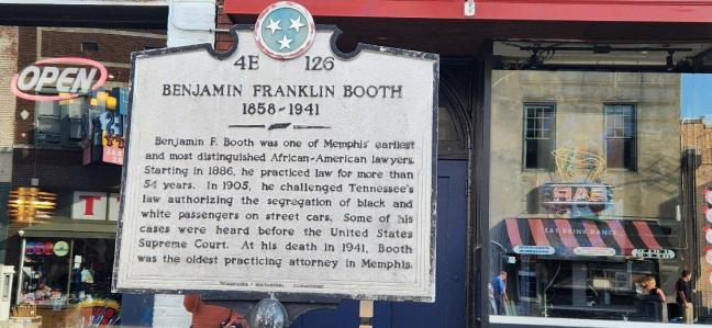
Benjamin Franklin Booth Historical Marker, Memphis, Tennessee

Benjamin Franklin Booth Historical Marker, Memphis, TN

Born into slavery, Benjamin Franklin Booth became a lawyer after the Civil War. He was self-taught, learning the local and state laws. He became a lawyer, teacher and principal.

Booth represented clients local to Memphis, TN. He even took a case all the way to the United States Supreme Court. He is perhaps best known for his 1905 lawsuit against segregation in streetcars.

Booth practiced law for 54 years and died in 1941.

Historical Marker Inscription

4E 126

Benjamin Franklin Booth

1858-1941

Benjamin F. Booth was one of Memphis’ earliest and most distinguished African-American lawyers. Starting in 1886, he practiced law for more than 54 years. In 1905, he challenged Tennessee’s law authorizing the segregation of black and white passengers on street cars. Some of his cases were heard before the United States Supreme Court. At his death in 1941, Booth was the oldest practicing attorney in Memphis.

Tennessee Historical Commission

Location

35° 8.39′ N, 90° 3.195′ W

Memphis, Tennessee, 38103, United States of America

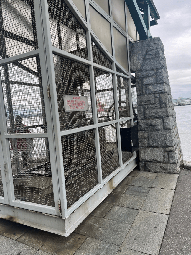
Nine O’Clock Gun, Stanley Park, Vancouver, Canada

Nine O'Clock Gun, Stanley Park, Vancouver, BC

The Nine O’Clock Gun was cast in England in 1816. It’s a naval-type, 12-pound, muzzle-loader cannon. It was brought to Vancouver in 1894. Fishermen used the gun to set their chronometers, and it also alerted them to when the fishing day was coming to a close. The gun replaced dynamite as the alert system.

The cannon is still used today. It fires at 9:00 p.m. It has also been sounded on New Year’s, to signal the end of World War II, and on Remembrance Day. During World War II, the gun remained silent.

You can find the Nine O’Clock Gun near the Georgia Street entrance to Stanley Park.

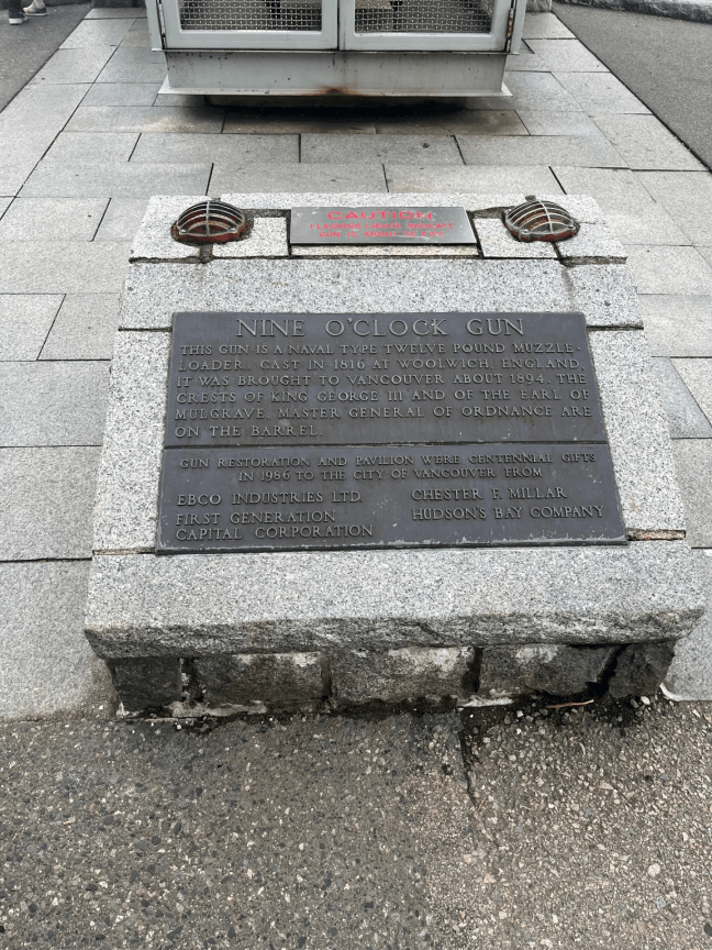
Nine O'Clock Gun Historical Marker, Stanley Park, Vancouver, BC

Historical Marker Inscription

This gun is a naval type twelve pound muzzle-loader. Cast in 1816 at Woolwich, England, it was brought to Vancouver around 1894. The crests of King George III and of the Earl of Mulgrave, Master General of Ordnance are on the barrel.

Gun restoration and pavilion were centennial gifts in 1986 to the City of Vancouver from:
EBCO Industries Ltd.                           Chester F. Millar
First Generation Capital Corporation  Hudson’s Bay Company

Location

49° 17’ 53.022” N, 123° 7’ 3.280” W
Stanley Park, 1601–1871 Stanley Park Dr, Vancouver BC, Canada

Citizen Driver Danny & Cindy George, Wheat Ridge, Colorado

Citizen Driver Award Danny & George Marker Wheat Ridge, CO

This marker is part of the TA & Petro Citizen Driver awards. It named Danny and Cindy George as winners. The Citizen Driver Program recognizes “exceptional drivers who demonstrate values of citizenship, community involvement, health and wellness, leadership and safety.”

The Georges have been driving trucks for more than 29 years and have a combined 6 million safe driving miles.

Historical Marker Inscription

On June 20, 2018, this location was dedicated to Danny and Cindy George, Citizen Drivers.

Living together in a small box for 29 years takes a lot of work and resourcefulness, but Danny and Cindy make it work beautifully. While one drives, the other sleeps. What drives their passion for trucking? Experiencing the food, culture and sights of North America and sharing their discoveries with others through their blogs and website.

Danny and Cidy have always been safety conscious and have over 6 million accident free miles. Their attention to safety has been recognized with multiple safety awards.

They are also dedicated to staying healthy and fit. They are always looking for the next location to bike, run or hike in order to help stay in shape on the road.

For Danny and Cindy, trucking has been the vehicle that has allowed them to financially support ministries and charities, including an orphanage in Nairobi, The Denver Rescue Mission and the Samaritan’s Purse.

The Citizen Driver program was developed to celebrate the best of the best in the trucking industry. This honor recognizes drivers who earn public respect for the industry through good citizenship, safety, community involvement, health and wellness and leadership.

TA – Travel Centers of America

Location

39° 46’ 44.958” N, 105° 8’ 4.990” W
12151 W 44th Ave, Wheat Ridge, CO  80033, United States


First Home of the Present Eastern Arizona College, Thatcher, Arizona

Eastern Arizona College Historical Marker, Thatcher, AZ

First chartered in 1888, the school was founded by the Church of Jesus Christ of Latter-day Saints. It was opened as the St. Joseph Stake Academy on December 18, 1890, making it Arizona’s oldest community college. It initially had 17 students.

The first classes were held in a church building in Central, Arizona. But most of the students had to travel from Thatcher. So, the school relocated to an adobe building in Thatcher. It moved several times after this, outgrowing each of the structures.

In 1895, the school suffered from serious debt. That same year, an epidemic of diphtheria and membranous croup claimed many children’s lives and forced the closing of the school for three weeks. When classes resumed, so few students showed up that the school closed for four years.

It did reopen and has continued to grow. It had a lot of success with sports, drama and music during the 1920s. Then, in 1932, the Church of Jesus Christ of Latter-day Saints gave control of the school to the community. It was then renamed Eastern Arizona College.

Historical Marker Inscription

First home of the present
Eastern Arizona College was
Central’s red-brick churchhouse
located just north of this marker.
Founded December 1890
The many-named school moved
the next year to Thatcher.

Location

32° 52’ 3.252” N, 109° 47’ 32.442” W
5475 W Central Rd, Thatcher, AZ  85546, United States

Hotel Georgia Historical Marker, Vancouver, BC

Hotel Georgia Historical Marker, Vancouver, BC

The Hotel Georgia was built between 1926 and 1927. It is a 12-story Georgian Revival-style hotel at the corner of Howe and West Georgia Streets. It was designed by R.T. Garrow and Seattle architect John Garam, Sr.

The hotel has hosted many prominent guests, including Marlene Dietrich; Elvis Presley; Errol Flynn; HRH Edward, Prince of Wales; John and Ethel Barrymore; and more.  Until 1941, it was also the location of one of the most popular radio stations, CKWX, which broadcasted from the hotel’s penthouse.

In 2011, the hotel was reopened as the Rosewood Hotel Georgia. It has undergone extensive renovations, the latest finishing in 2024.

Historical Marker Inscription

This distinguished hotel designed in the Georgian Revival style was opened in 1927 by Edward Prince of Wales, who later became King Edward VII. Through the 1920s prominent buildings such as this were quickly replacing the area’s early houses and apartments. For decades it was a social centre at the heart of the city’s downtown, home to the Newsman’s Club, the ladies’ Georgian Club and generations of UBC students in the downstairs ‘George V’ pub. The hotel has hosted many diplomats and distinguished guests, including celebrities such as John Wayne, Nat King Cole, Elvis Presley and the Rolling Stones. An extensive rehabilitation completed in 2011 included installing a corner blade sign similar to one from the 1930s, and restoring its richly-detailed wood-paneled lobby, terrazzo, flooring, ballroom, plasterwork, curved staircase, and second floor meeting rooms.

The hotel reopened its doors in the summer of 2011 as the Rosewood Hotel Georgia. In 2007 Hotel Georgia Development Ltd., in association with Delta Land Development Ltd., began extensive exterior and interior rehabilitation and restoration of the hotel. The project team under the leadership of renowned architectural firm Endall Elliot Associates in conjunction with international interior designer Munge Leung Associates was dedicated to restoring this heritage Ceorgian Revival hotel to its original grandeur.

Location

49° 16’ 59.520” N, 123° 7’ 8.820” W
693–699 Howe St, Vancouver BC V6C 2E5, Canada

The Dead Are Speaking Historical Marker, Skagway, Alaska

The Dead Are Speaking Historical Marker, Skagway, Alaska

In the prospectors’ rush to find gold in Alaska, nearly 3,000 pack animals died crossing the White Pass trail during the Klondike gold rush. Horses were given little thought, often dying of starvation or falling over cliffs. The horses were often overloaded with supplies and were beaten by their owners.

Because of the atrocities, novelist Jack London renamed the pass “Dead Horse Trail”. In fact, many of the animals’ bones still lay in Dead Horse Gulch.

Between 20,000 and 30,000 people came seeking gold during the rush. They had to carry everything with them. It wasn’t until the tram was built in 1897 that the need for horses decreased.

This marker memorializes these pack animals.

Historical Marker Inscription

The dead are speaking in memory of us three thousand pack animals that laid our bones on these awful hills during the Gold Rush of 1897-1898. We now thank those listening souls that heard our groans across this stretch of years. We waited but not in vain.

Placed by the Ladies of the Golden North and the Alaska Yukon Pioneers

Location

59° 27’ 10.770” N, 135° 19’ 9.942” W

231 Second Ave, Skagway, AK  99840, United States

First Permanent Emigrant Trail Markers Historical Marker, Truckee, California

First Permanent Emigrant Trail Makers Historical Marker

In 1929, the Native Sons of the Golden West created two monuments to indicate the changes to the 1846 Emigrant Trail. One of the original trail markers was located on Old Highway 40, better known as Donner Pass Road, near the end of what’s now Northwoods Boulevard.

To the right of this monument, P.M. Weddell added a wooden sign to indicate the correct direction down the mountain. The second monument was located at the entrance of Coldstream Canyon on Highway 40.

Historical Marker Inscription

The nearby monument was envisioned in 1929 by C. F. McGlashan, Truckee’s foremost resident 1872-1931 and author of the 1880 classic, The History of the Donner Party; P.M. Weddell, who placed wooden signs on the Donner Trail from Verdi, Nevada over Coldstream Pass to Lake Mary from 1924 until his death in 1951; and W.F. Knowland, U.S. Senator (1945-1959) and the chairman of The Native Sons of the Golden West’s Landmark Commission.

The three trail authorities met in McGlashan’s law office in Truckee to draw up the text for the plaque on this monument, listed as #3 on the map to the right and a companion plaque for the monument listed as #5, located one half mile to the west on old Hwy 40 and Coldstream Road.

Dedicated November 16, 2014 (6019)
By Truckee Donner Historical Society and
Chief Truckee Chapter of E Clampus Vitus

Location

39° 19’ 32.910” N, 39° 19’ 32.910” N
11769–11771 Donner Pass Rd, Truckee, CA  96161, United States

Jamison City, Eureka Mine and Mill, Johnstown Historical Marker, Blairsden Graeagle, CA

Jamison City, Eureka Mine and Mill and Johnstown Historical Marker

This historical marker groups together four different historical sites. These include sites that now encompass the Plumas-Eureka State Park.  Most of these towns have few residents or have completely disappeared.

For example, Johnstown, now Johnsville, was founded in 1876 and now has around 12 residents. Jamison City has completely disappeared. Jamison City was a mining town and became famous after a 52-pound gold nugget was discovered in the Eureka Quartz vein.

The vein was first discovered in 1851 and would eventually yield $17 million in gold. The Plumas-Eureka and Jamison City mines would continue to be used until the early 1900s.

Historical Marker Inscription

Jamison City
Eureka Mine
Johnstown

Along the Pioneer Trail lies Jamison City and Mine. Large producer, famous for its 52-pound nugget; Eureka Mill and Mine yielding $17 millions to Cornish miners and others. Johnstown, now Johnsville, well preserved ’49 town.

Historical Landmark No. 196

Department of Public Works – Divison of Highways

Location

39° 47’ 18.738” N, 120° 38’ 2.442” W
65521–65543 CA-70, Blairsden Graeagle, CA  96103, United States

Peter Skene Ogden Historical Marker, Terrebonne, Oregon

Peter Skene Ogden Historical Marker, Terrebonne, Oregon

Born somewhere between 1790 and 1794 in Quebec, Canada, Peter Skene Ogden was a trapper during the height of the beaver trade. He was a member of the Hudson’s Bay Company even after it merged with the Northwest Fur Company in 1821.

In 1824, Ogden was tasked by John McLoughlin to lead the Snake River Country Expeditions. His goal was to discourage American trappers from entering the area to maintain British control of the trade. Along with the traders were a group of Americans directed by Jedediah Smith.

The two sets of traders separated at Beaver River, and Ogden continued south. This took the group through what is now Smithfield, Hyrum, Logan and Huntsville. While the town of Ogden bears his name, it is unlikely that the man himself visited the area.

Ogden was forced from going any further on his journey after an argument with the “Ashley Men” who convinced many of Ogden’s men to defect with 700 pelts. He returned to the Flathead Post.

Ogden would continue to lead many expeditions for the Hudson’s Bay Company. He had a large impact on the fur trade. He would return to Utah for an expedition from 1828 to 1829. After that, he would never again return to what would become the State of Utah.

Ogden would continue working for the Hudson’s Bay Company until a few months before his death in 1854.

Historical Marker Inscription

This park is named for Peter Skene Ogden, 1793-1854. In the fall of 1825, Ogden led a Hudson’s Bay Company trapping party on the first recorded journey into central Oregon, crossing the country to the north and east into the Crooked River Valley not far above here. He was in the vicinity again in 1826 bound for the Harney Basin and the Klamath region where he discovered Mount Shasta. Ogden was an important figure in the early fur trade and ranged over all the West. He rescued the survivors of the Whitman Massacre.

Ogden, Utah, was named for him.

Location

44° 23’ 25.398” N, 121° 11’ 34.968” W
Peter Skene Ogden State Scenic Viewpoint, Terrebonne, OR  97760, United States