Born in 1870 and originally from Kansas, Enos A. Mills moved to Colorado during the early years of his life. He first ascended Longs Peak (14,255 feet tall) at 15. In 1887, Mills moved to Montana but would spend his summers traveling the West Coast.
After meeting naturalist John Muir in 1889 in California, Mills dedicated his life to conserving the natural world. Mills returned to Colorado in 1902 and bought a homestead in Estes Park. From here, he would take guests into the Rocky Mountain wilderness.
From 1902 to 1906, Mills worked as the Colorado State Snow Observer, where he measured snow depths. This helped predict spring and summer runoffs. From 1907 to 1909, he was also a government lecturer on forestry.
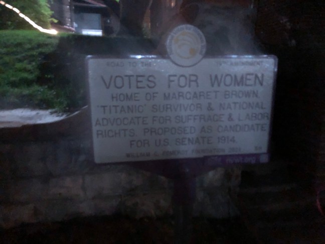
But Mills is best known for trying to protect the area around Longs Peak and turn it into a national park. Working with groups like the Sierra Club and the Daughters of the American Revolution, Mills finally got Congressional approval to create Rocky Mountain National Park in 1915.
Mills would summit Longs Peak 340 times both by himself and as a guide. He became known as the “Father of Rocky Mountain National Park”. Mills died in 1922 at the age of 52.
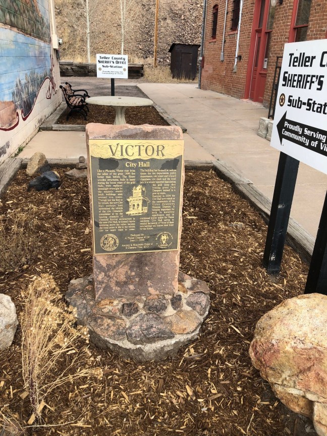
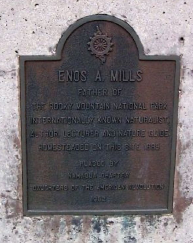
Historical Marker Inscription
Father of
the Rocky Mountain National Park
internationally known naturalist, author, lecturer and nature guide
Homesteaded on this site in 1885
Placed by NAMAQUA Chapter, Daughters of the American Revolution
1952
Location
40° 16.795′ N, 105° 32.487′ W
Estes Park, Colorado