Sahuaro Ranch Historical Marker, Glendale, AZ

Sahuaro Ranch Glendale, AZ

Sahuaro Ranch is a 17-acre ranch that has been preserved by the City of Glendale. William Bartlett was 36 years old in 1886 when he came from Peoria, Illinois, to invest in the ranch located north of Phoenix. He and his brother Samuel purchased 640 acres under the Desert Land Act of 1877.

Being able to homestead in the area only became possible after the creation of the Arizona Canal, which was completed in 1885, opening up the Salt River Valley to agriculture. Bartlett was a successful rancher, growing everything from fruit to grain to cotton. The ranch itself was well-landscaped with rose bushes, palms and many other types of plants. The ranch also raised cattle, hogs and bulls.

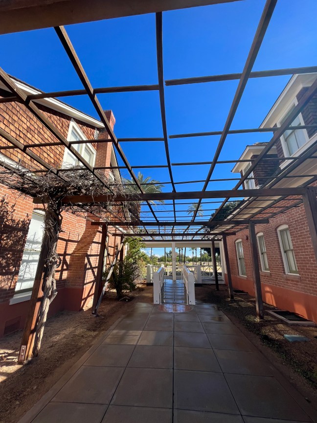
By 1887,  the Adobe House, a horse barn and a blacksmith shop was on the property. The fruit orchard also expanded in 1890, including olives and oranges. These were some of the first grown in the area. The Guest House was built in 1898 by J. L. Silsbee, a Chicago architect who was an employer of Frank Lloyd Wright.

The ranch thrived throughout the 1900s, with other owners, including P.E. Bradshaw and Richard W. Smith. By the 1970s, much of the ranch had been sold off. The City of Glendale purchased the remaining 80 acres in 1972 and converted it into a park and historical area and other facilities.

Historical Marker Inscription

Sahuaro Ranch Historical Marker, Glendale, AZ

National Register of Historic Places
Listed March 7, 1980
United States Department of the Interior

Sahuaro Ranch was one of the first farms in the Glendale area and a reminder of Glendale’s agricultural beginnings. Started by wealthy Illinois businessman William H. Bartlett in 1886, the ranch was a commercial operation and became known as the “Showplace of the Valley.” Ranch owners, including Bartlett, produced fruit, grains and cotton, ranched cattle, raised horses and operated a dairy. As farms gave way to houses, the City of Glendale purchased the remaining parts of the ranch in 1977. The City preserved 17 acres of the original ranch along with 13 buildings and a historic landscape of trees and irrigation ditches.

Location

33° 34’ 31.488” N, 112° 11’ 18.870” W
Sahuaro Ranch Park, Glendale, AZ  85302, United States

Pipe Spring National Monument Historical Marker

Pipe Spring National Monument Windsor Castle Arizona

Located on the Arizona Strip, Pipe Spring National Monument lies on very arid land. But water exists here. The area benefits from the rain and snowmelt from central Utah’s high plateau. Water flows down into a hard shale layer and then moves to the base of Arizona’s Vermillion Cliffs. Here, it is pushed to the surface. Pipe Spring is one of the locations where this happens.

Because water is so vital to so many people, many different types of groups were sustained by this spring. For over 12,000 years, this area has been frequented by everyone from nomadic hunters to the Ancestral Puebloan people to the Church of Jesus Christ of Latter-Day Saints.

It was the Mormon pioneers who built the buildings in the national monument. They began occupying the area in the late 1850s. Their control of the springs brought them into conflict with the Paiute and Navajo Native American tribes. The Mormons had moved sheep and cattle into the area. This infuriated the Native peoples. The Navajo tribes raided the livestock, and in 1866, James Whitmore was killed trying to recover his lost livestock.

In 1868, Mormon militiamen built a stone cabin to protect against the raids. Later, under Brigham Young, they created a ranch here. It served as both a successful business and as a refuge for Mormon people seeking refuge against the anti-polygamy laws. The Mormons sold the ranch in 1895.

On May 31, 1923, Pipe Spring National Monument was created by President Warren G. Harding.

Pipe Spring National Monument Historical Marker Arizona

Historical Marker Inscription

PIPE SPRINGS NATIONAL MONUMENT
Established May 31, 1923
Through efforts of Stephen T. Mather and friends.

PIPE SPRINGS
Occupied in 1863, by Dr. James M Whitmore, who, with Robert McIntire was killed 4 miles S.E. of Pipe Springs January 8, 1866, by Navajo and Piute Indians.

WINDSOR CASTLE
Erected by direction of Brigham Young in 1869-70 by Anson Windsor for handling the Church tithing herds and as a frontier refuge from Indians. It became the first telegraph office in Arizona when the Deseret Telegraph Line reached here in December 1871.

Utah Pioneer Trails and Landmarks Association and Citizens of Kanab Stake

Pipe Spring National Monument

Location

36° 51’ 47.652” N, 112° 44’ 22.122” W

Pipe Spring National Monument, Ridge Trail, Valentine, AZ  86437, United States

Dominguez Y Escalante Expedition 1776 – 1976

Located in Marble Canyon on Highway U.S. 89A at mile post 557, this spot commemorates a portion of the Dominguez y Escalante Expedition. While the marker itself is missing, you can see the stone holder of where it used to be.

Father Silvestre Velez Escalante and Father Francisco Atanasio Dominguez were co-leaders of an expedition, along with 10 companions, that left Santa Fe, NM, to try and a find a route to Monterey, CA. The Dominguez-Escalante Expedition began in July 1776, but was having trouble less than 10 weeks after leaving Santa Fe.

Near Thermo Hot Springs in Utah, they ran into a blizzard, and supplies were running short. The members of the crew drew lots to determine whether they should try to continue forward or turn back to Santa Fe. The outcome was that they turned around and were back in Santa Fe on January 2, 1777.

Dominguez-Escalante Expedition Historical Marker

Located near the Vermillion Cliffs, according to the Historical Marker Database, this marker memoralizes the following:

Within sight of this place the Franciscan priests Dominguez and Escalante and their ten companions experienced two of the most difficult challenges among many along the 1,800 miles of their epic journey from the Spanish presidio at Santa Fe, New Mexico.

IMG_0745