Victor, Colorado, was founded in 1891 after gold was discovered in the nearby Cripple Creek mining district. The location eventually became known as the City of Mines, and the largest gold mine was on Battle Mountain above Victor.
The original buildings were wood and were burned down in a fire in 1899. The new buildings were made of brick, including the City Hall. The City Hall is the highlight of the Victor Downtown Historic District, which is listed on the National Register of Historic Places.

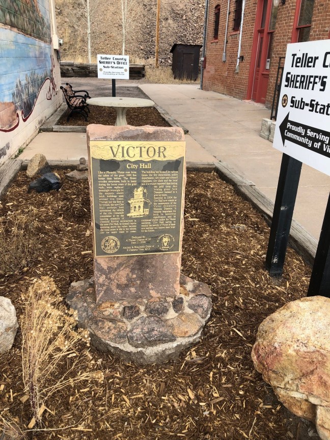
Historical Marker Inscription
Like a Phoenix, Victor rose from the ashes of the great 1899 fire better than before. The flimsy wooden structures, built in haste during the boom years of the gold rush, were replaced seemingly overnight by the majestic sturdy brick buildings seen around you today. Though not the first to be rebuilt, the new City Hall perhaps best epitomized the rebirth of the city. Generally considered to be the leading example of Classical Revival architecture in the area City Hall, its domed cupola towering above the valley, became the focal point of life in the reborn city for many years to come.
The building has housed, at various times, the fire department, police department, city court and council chambers, city clerk and local jail. It is widely reported that during the gold camp days boxing great Jack Dempsey trained in a gym up stairs.
Restored in 2004 the City Hall now stands as a centerpiece of the Victor Downtown Historic District. It remains important for both its historical significance and its continued public utility for Victor residents. City Hall serves to remind the people of Victor of their rich heritage and inspire their hope for the future.
Dedicated by Al Packer Chapter #100 June 21, 2008
Ancient & Honorable Order of E Clampus Vitus 6013
Location
38° 42’ 38.220” N, 105° 8’ 33.340” W
500 Victor Ave, Victor, CO 80860, United States