Near Jefferson, located in Park County, Colorado, is the ghost town of Tarryall. It was once known as Tarryall City and was a town created by the gold rush. The town was founded in 1859 and was in existence for four years.
Apparently, the name came from when a group of miners that included William J. Holman and Earl Hamilton stumbled across a stream in South Park looking for gold. The group was exhausted and wanted to “tarry here”. Another member responded, “Yes, we’ll tarry all.” And the name was born. Soon, it also became clear that the stream was filled with gold.
The belief that there was abundant gold in the area encouraged miners to head out to this area of South Park. The town of Tarryall City was created on one side of the stream, and Hamilton was built on the other. The town at its height had approximately 6,000 people. Around $2 million in gold value at the time was collected from the Tarryall Diggings. Even today, visitors can find well over 11,000 mines that were once active in the area.
However, by the end of 1861, Tarryall City and its neighbor Hamilton had quickly declined. By 1867, they were virtually ghost towns.
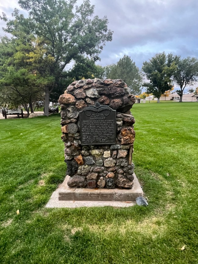
Historical Marker Description
This memorial is the property of the State of Colorado
Extending up the creek to the mountains were the
Tarryall Diggings
Discovered in July, 1859. Towns of Hamilton and Tarryall (2 miles west) thrived in 1860s. A newspaper and numerous business houses flourished. The towns have long since disappeared. Large trees now grow in the sluice tailings on the bluff ½ mile west. The diggings have produced $2,000,000 in gold.
Erected by by The State Historical Society of Colorado.
From The Mrs. J.N. Hall Foundation and by Foster Cline
1933
Location
39° 19.971′ N, 105° 52.035′ W
Jefferson, Colorado
 Historical Marker Inscriptions