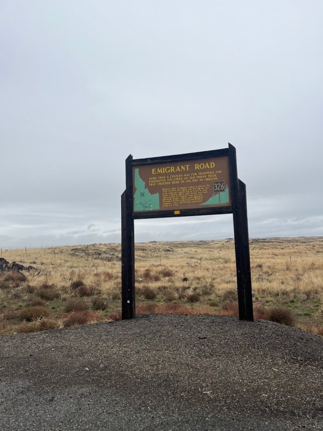
This trail was the original wagon route that went over Donner Summit when emigrants moved west towards California. During the 1850s and 1860s, emigrants were heading to California, hoping to obtain land, gold or new opportunities. They often faced harsh conditions from the weather, terrain and attacks from Native Americans whose lands they were traversing or trying to take over.
The Emigrant Trail crossed many Midwestern states. Pioneers along this trail would eventually reach California, Utah, Washington or Oregon.
Currently, the trail is a recreational area for biking, hiking and other activities.
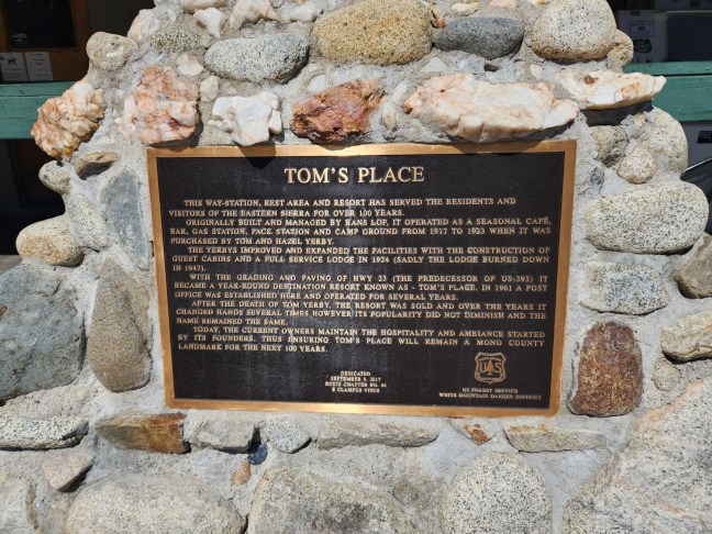
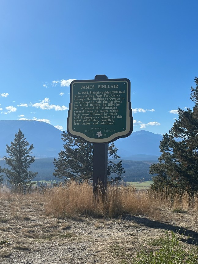
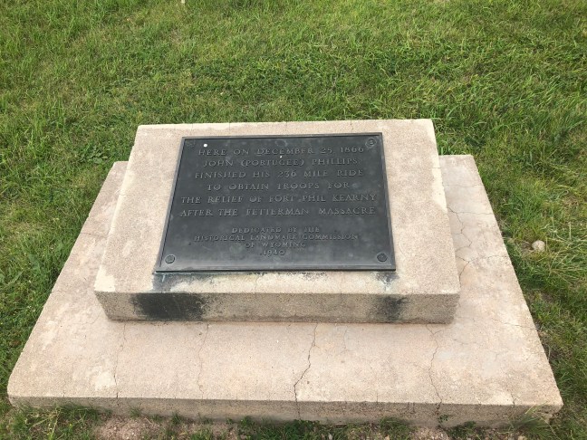
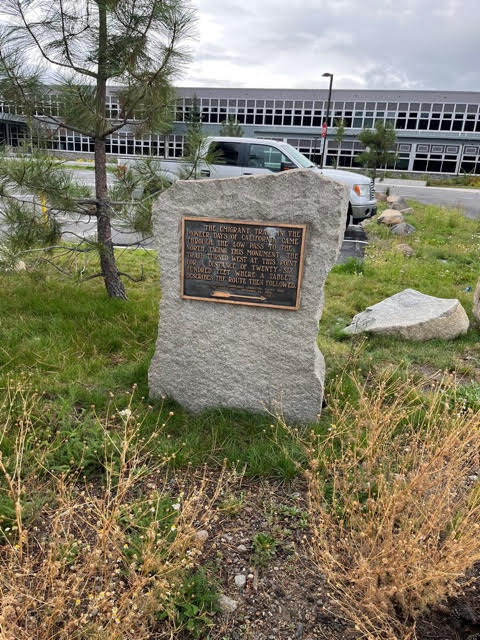
Historical Marker Inscription
The Emigrant Trail in the pioneer days of California came through the low pass to the north, facing this monument. The trail turned west at this point for a distance of twenty-six hundred feet where a tablet describes the route then followed.
Placed by Historic Landmarks Committee, Native Sons of the Golden West, September 14, 1929.