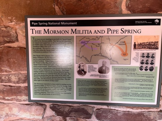
Located on the Arizona Strip, Pipe Spring National Monument lies on very arid land. But water exists here. The area benefits from the rain and snowmelt from central Utah’s high plateau. Water flows down into a hard shale layer and then moves to the base of Arizona’s Vermillion Cliffs. Here, it is pushed to the surface. Pipe Spring is one of the locations where this happens.
Because water is so vital to so many people, many different types of groups were sustained by this spring. For over 12,000 years, this area has been frequented by everyone from nomadic hunters to the Ancestral Puebloan people to the Church of Jesus Christ of Latter-Day Saints.
It was the Mormon pioneers who built the buildings in the national monument. They began occupying the area in the late 1850s. Their control of the springs brought them into conflict with the Paiute and Navajo Native American tribes. The Mormons had moved sheep and cattle into the area. This infuriated the Native peoples. The Navajo tribes raided the livestock, and in 1866, James Whitmore was killed trying to recover his lost livestock.
In 1868, Mormon militiamen built a stone cabin to protect against the raids. Later, under Brigham Young, they created a ranch here. It served as both a successful business and as a refuge for Mormon people seeking refuge against the anti-polygamy laws. The Mormons sold the ranch in 1895.
On May 31, 1923, Pipe Spring National Monument was created by President Warren G. Harding.

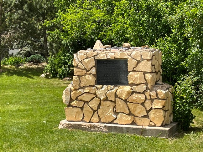
Historical Marker Inscription
PIPE SPRINGS NATIONAL MONUMENT
Established May 31, 1923
Through efforts of Stephen T. Mather and friends.
PIPE SPRINGS
Occupied in 1863, by Dr. James M Whitmore, who, with Robert McIntire was killed 4 miles S.E. of Pipe Springs January 8, 1866, by Navajo and Piute Indians.
WINDSOR CASTLE
Erected by direction of Brigham Young in 1869-70 by Anson Windsor for handling the Church tithing herds and as a frontier refuge from Indians. It became the first telegraph office in Arizona when the Deseret Telegraph Line reached here in December 1871.
Utah Pioneer Trails and Landmarks Association and Citizens of Kanab Stake
Location
36° 51’ 47.652” N, 112° 44’ 22.122” W
Pipe Spring National Monument, Ridge Trail, Valentine, AZ 86437, United States