Born somewhere between 1790 and 1794 in Quebec, Canada, Peter Skene Ogden was a trapper during the height of the beaver trade. He was a member of the Hudson’s Bay Company even after it merged with the Northwest Fur Company in 1821.
In 1824, Ogden was tasked by John McLoughlin to lead the Snake River Country Expeditions. His goal was to discourage American trappers from entering the area to maintain British control of the trade. Along with the traders were a group of Americans directed by Jedediah Smith.
The two sets of traders separated at Beaver River, and Ogden continued south. This took the group through what is now Smithfield, Hyrum, Logan and Huntsville. While the town of Ogden bears his name, it is unlikely that the man himself visited the area.
Ogden was forced from going any further on his journey after an argument with the “Ashley Men” who convinced many of Ogden’s men to defect with 700 pelts. He returned to the Flathead Post.
Ogden would continue to lead many expeditions for the Hudson’s Bay Company. He had a large impact on the fur trade. He would return to Utah for an expedition from 1828 to 1829. After that, he would never again return to what would become the State of Utah.
Ogden would continue working for the Hudson’s Bay Company until a few months before his death in 1854.
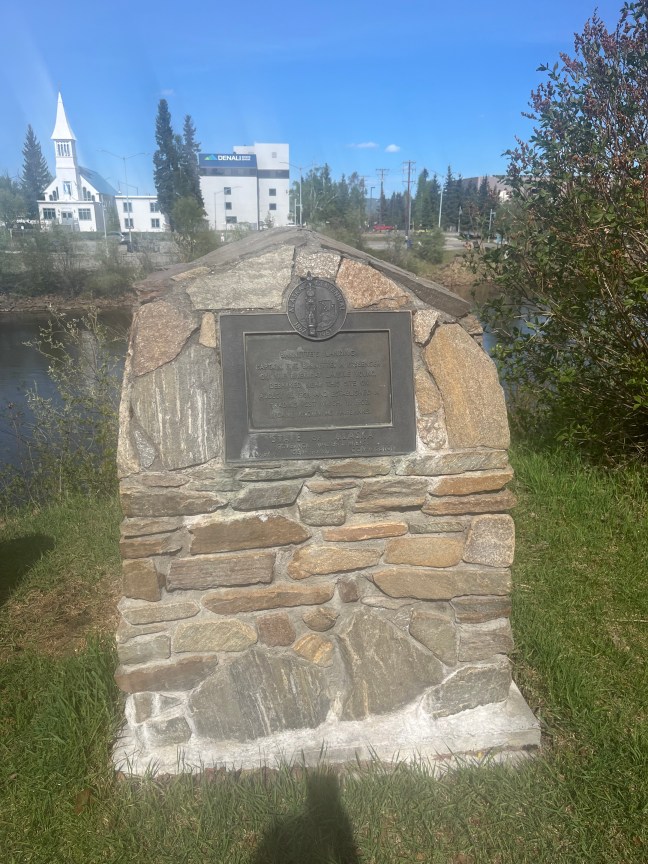
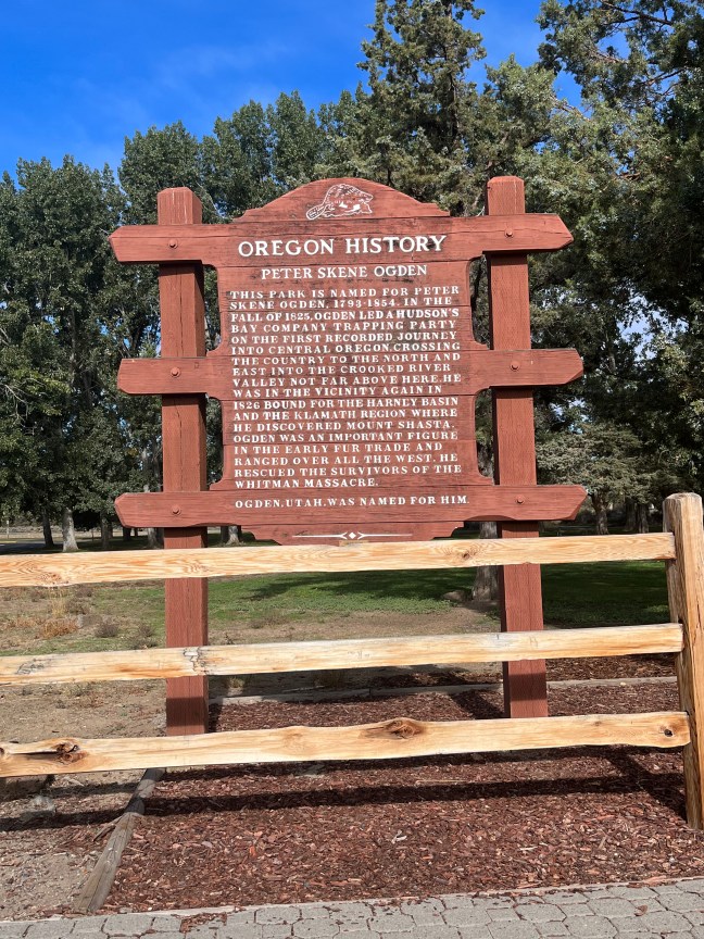
Historical Marker Inscription
This park is named for Peter Skene Ogden, 1793-1854. In the fall of 1825, Ogden led a Hudson’s Bay Company trapping party on the first recorded journey into central Oregon, crossing the country to the north and east into the Crooked River Valley not far above here. He was in the vicinity again in 1826 bound for the Harney Basin and the Klamath region where he discovered Mount Shasta. Ogden was an important figure in the early fur trade and ranged over all the West. He rescued the survivors of the Whitman Massacre.
Ogden, Utah, was named for him.
Location