The Rhythm Club was a dance hall that was a central part of life for African Americans in Natchez, MS. The Rhythm Club Fire occurred on April 23, 1940, killing 209 people. All the people who died in the club were African American.
While this has become a case study for firefighters, and it ranks in the top five of deadliest fires, few in the public actually know about the tragedy.
On the night of the fire, band leader Walter Barnes and His Royal Creolians added an additional stop on their tour in Natchez. Since Walter Barnes was extremely popular, the club was packed, with over 700 people paying the cover to hear them.
At some time near midnight, a fire broke out at the club’s entrance. It quickly spread, helped by flammable insecticide that had been put on the Spanish moss.
With boarded-up exits, and the front doors the only way out, the crowd rushed to the front. Since the doors swung inwards, the rush of the crowd prevented the doors from opening. Hundreds were trapped inside with the band still played to try and calm the crowd.
Many who died were teens. Many deaths were caused by asphyxiation or from being scalded to death when the water from the fire hoses came in contact with the corrugated metal, which caused deadly steam. Others were trampled to death as people tried to reach the exit. The rest were burned.
The club owner and Walter Barnes and many of his band members were among the dead.
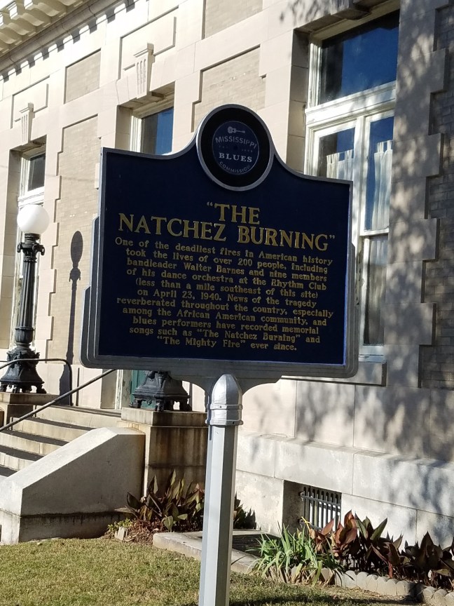
Historical Marker Inscription
One of the deadliest fires in American history took the lives of over 200 people, including bandleader Walter Barnes and nine members of his dance orchestra at the Rhythm Club (less than a mile southeast of this site) on April 23, 1940. News of the tragedy reverberated throughout the country, especially among the African-American community, and blues performers have recorded memorial songs such as “The Natchez Burning” and “The Mighty Fire” ever since.
Location
Intersection of Main Street and North Wall Street, Downtown, Natchez, Mississippi
N31° 33.651′, W 91° 24.249′