
The Carrollton Historic District is approximately two and a half square miles with buildings that date from around 1880 to 1937. The town of Carrollton began on the site of the former Macarty sugar plantation, which was originally located in Jefferson Parish. The property had been acquired by Laurent Millaudon, Samuel Kohn and John Slidell, real estate investors, as well as the New Orleans Canal and Banking Company. The land was subdivided in 1833, and the town of Carrollton was born.
The town was connected to New Orleans via the New Orleans and Carrollton Railroad, which would take passengers between the two areas two hours a day, seven days a week. Later in 1851, the Jefferson and Lake Ponchartrain Railroad was started. The ease of transportation created a real estate boom. The number of houses in the town went from 36 in 1841 to 1,470 within 10 years. People in the middle and upper classes lived in the area.
Incorporated on March 10, 1845, the town of Carrollton eventually became a city on March 17, 1859. It was even the parish seat from 1852 to 1874. It was finally annexed by City of New Orleans in 1874.
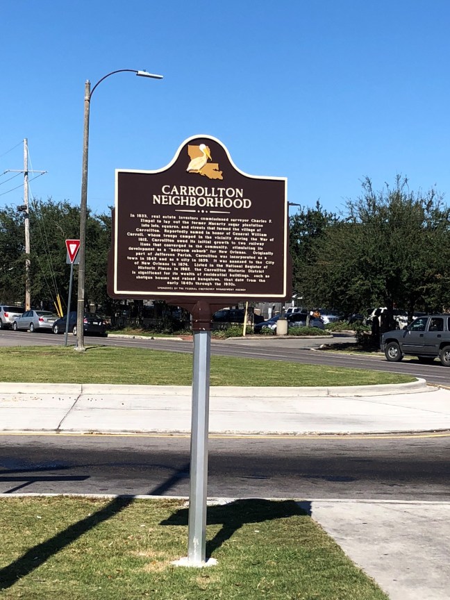
Historical Marker Inscription
In 1833, real estate investors commissioned surveyor Charles F. Zimpel to lay out the former Macarty sugar plantation into lots, squares, and streets that formed the village of Carrollton. Reportedly named in honor of General William Carroll, whose troops camped in the vicinity during the War of 1812, Carrollton owed its initial growth to two railway lines that converged in the community, stimulating its development as a “bedroom suburb” for New Orleans. Originally part of Jefferson Parish, Carrollton was incorporated as a town in 1845 and as a city in 1859. It was annexed to the City of New Orleans in 1874. Listed in the National Register of Historic Places in 1987, the Carrollton Historic District is significant for its wealth of residential buildings, such as shotgun houses and raised bungalows, that date from the early 1840s through the 1930s.
Location
Intersection of South Claiborne Avenue and South Carrollton Avenue
29° 57.362′ N, 90° 7.245′ W
