Blog

Howard’s Lick/Jackson Home Historical Marker, Mathias, WV

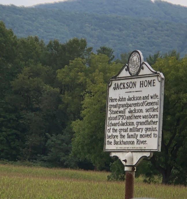
Jackson Home / Howard's Lick Historical Marker, Mathias, WV

This site features two historical markers: Howard’s Lick and Jackson Home.

Currently known as Lee White Sulphur Springs, the first sign refers to what was originally called Howard’s Lick, which is a spring that has become a health resort. The Commonwealth of Virginia gave a portion of the area around the spring to General Henry Lee in 1796, who was a Revolutionary War hero.

When Lee died in 1818, four sons inherited his property, including the property located in Hardy County. Charles Carter Lee eventually took possession of all this land. Charles was the older brother of General Robert E. Lee of American Civil War fame.

The area was also the location of the Jackson home, where John Jackson and his wife lived starting in 1750. These were the great grandparents of another Confederate war general, General Thomas Jonathan “Stonewall” Jackson.

Historical Marker Inscription

Side 1

Howard’s Lick

Howard’s Lick, also known as Lee White Sulphur Springs, was once owned by General Henry “Light Horse Harry” Lee of Revolutionary War fame. It was owned later by Charles Carter Lee, brother of the beloved General Robert E. Lee.

Side 2

Jackson Home

Here John Jackson and wife, great grandparents of General “Stonewall” Jackson, settled about 1750 and here was born Edward Jackson, grandfather of the great military genius before the family moved to Buckhannon River.

Location

13208 WV-259, Mathias, West Virginia 26812, United States

38° 52′ 48.132″ N, 78° 51′ 54.930″ W

Combahee River Raid

Combahee River Raid Historical Marker, Beaufort, South Carolina

Harriet Tubman, famous for her assistance with the Underground Railroad to help slaves from the South travel to the North to freedom, worked with 150 black Union soldiers (members of the 2nd South Carolina Volunteers) to free more than 750 enslaved peopled on June 2, 1863. It became known as the Combahee River Raid. Under the command of Union Colonel James Montgomery, Tubman became the first woman to lead a “major military operation in the United States”.

Slaves along the Combahee River worked with Tubman to ensure that the Union vessels remained safe throughout the voyage. They provided information about the location of rebel torpedoes in the river in exchange for freedom. While the mission did help free many slaves, the main goal was to destroy estates owned by South Carolina secessionists, which they also achieved.

Tubman, often referred to as “the Moses of her people”, was a slave who had fled the South in 1849.

Historical Marker Inscription

Combahee River Raid
On June 1-2, 1863, a Federal Force consisting of elements of the 2nd S.C. Volunteer Infantry (an African- American unit) and the 3rd Rhode Island Artillery conducted a raid up the Confederate-held Combahee River. Col. James Montgomery led the expedition. Harriet Tubman, already famous for her work with the Underground Railroad, accompanied Montgomery on the raid.

(Other Side)

Freedom Along The Combahee
Union gunboats landed 300 soldiers along the river, and one force came ashore here at Combahee Ferry. Soldiers took livestock and supplies and destroyed houses, barns, and rice at nearby plantations. More than 700 enslaved men, women, and children were taken to freedom in perhaps the largest emancipation event in wartime S.C. Some freedmen soon enlisted in the U.S. Army.

Location

999, Charleston Highway, Beaufort County, South Carolina, 29945 United States

32° 39′ 6.94″ N, 80° 41′ 5.85″ W


Temple of Sport, Green Pond, SC

Temple of Sport Historical Marker, Green Pond, South Carolina

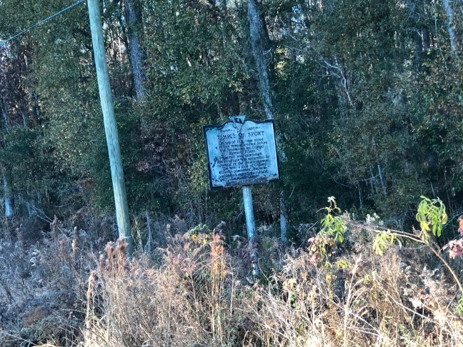
This site marks the location of a grandiose deer stand that had eight brick columns approximately two feet in diameter at the base. The deer stand stood at the headwaters of the Chehaw River, which attracted many animals to the area.

The structure was built by Colonel Barnard Elliott sometime after approximately 1768. Elliott was the first to read the American Declaration of Independence to the public in South Carolina, which happened on August 5, 1776.

Historical Marker Inscription

On top of this ridge stood a sylvan temple erected before the Revolution by Colonel Barnard Elliott, patriot and sportsman. The structure was supported by columns in the classic manor. The site, a part of Colonel Elliot’s plantation “Belleview,” afforded an excellent stand for hunting deer.

Location

Ace Basin Parkway, Green Pond, South Carolina, 29446, United States

32° 42′ 30.168″ N, 80° 36′ 41.220″ W

Feliciana Courthouse, Louisiana

Feliciana Courthouse Historical Marker, Louisiana

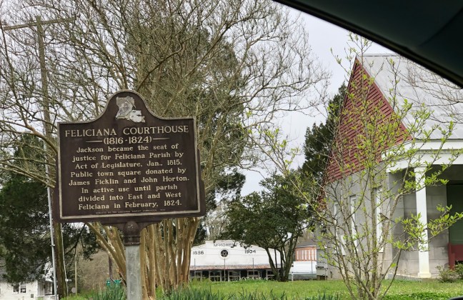
The Old Feliciana Parish Courthouse was built in 1816 and was placed on the National Register of Historic Places in 1980. It served as the courthouse from 1816 to 1824 when the parishes were split between West Feliciana (Saint Francisville current county seat) and East Feliciana Parish (Clinton current county seat).

Historical Marker Description

(1816-1864)

Jackson became the seat of justice for Feliciana Parish by Act of Legislature, Jan., 1815. Public town square donated by James Ficklin and John Horton. In active use until parish divided into East and West Feliciana in February, 1824.

Location

1734 High Street, Jackson, LA, 70148, United States

30° 50′ 16.680″ N, 91° 12.′ 50.388″ W

Menominee River Historical Marker, Marinette, Wisconsin

Menominee River Historical Marker, Marinette, Wisconsin

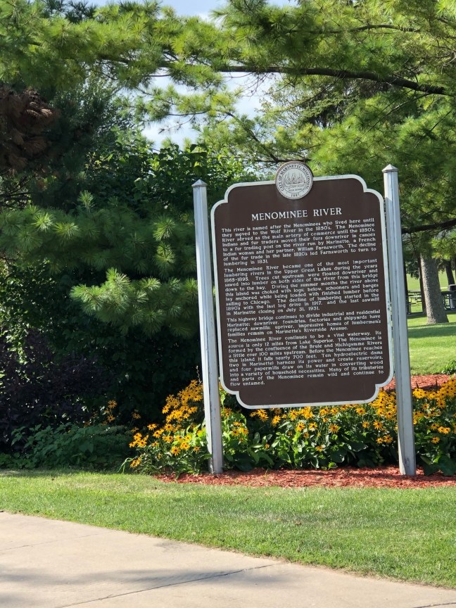
Named after the Menominee Indians of Wisconsin, the Menominee River is about 120 miles long and is the border between Wisconsin and Michigan’s Upper Peninsula. It eventually drains into Lake Michigan at Green Bay.

The river is important to the Native American tribe it’s named after, considering there is a creation myth about how their people’s came into existence at the river’s mouth.

It is a destination for fishing, hiking and water activities, and it is crucial for drinking water.

Historical Marker Inscription

This river is named after the Menominees who lived here until they moved to the Wolf River in the 1850’s. The Menominee River served as the main artery of commerce until the 1850’s. Indians and fur traders moved their furs downriver in canoes to a fur trading post on the river run by Marinette, a French Indian woman and her partner, William Farnsworth. The decline of the fur trade in the late 1820’s led Farnsworth to turn to lumbering in 1831.

The Menominee River became one of the most important lumbering rivers in the Upper Great Lakes during the years 1865–1895. Trees cut upstream were floated downriver and sawed into lumber on both sides of the river from this bridge down to the bay. During the summer months the river above this island was choked with logs; below, schooners and barges lay anchored while being loaded with finished lumber before sailing to Chicago. The decline of lumbering started in the 1890’s, with the last log drive in 1917, and the last sawmill in Marinette closing on July 31, 1931.

This highway bridge continues to divide industrial and residential Marinette; downriver, foundries, factories and shipyards have replaced sawmills; upriver, impressive homes of lumbermen’s families remain on Marinette’s Riverside Avenue.

The Menominee River continues to be a vital waterway. Its source is only 12 miles from Lake Superior. The Menominee is formed by the confluence of the Brule and Michigamme Rivers a little over 100 miles upstream. Before the Menominee reaches this island it falls nearly 700 feet. Ten hydroelectric dams (two in Marinette) harness its power and create reservoirs, and four papermills draw on its water in converting wood into a variety of household necessities. Many of its tributaries and parts of the Menominee remain wild and continue to flow untamed.

Location

Stephenson Island Park, 499 Bridge Street, Marinette, WI 54143 United States

45° 6′ 6.820″ N, 87° 37′ 44.940″ W

Boré Plantation – Audubon Park, New Orleans, LA

Bore Plantation - Audubon Park Historical Marker, New Orleans, LA

Audubon Park was the location of the Boré Plantation owned by Étienne de Boré, which started as an indigo plantation, but later converted into sugar cane. The process was assisted by chemist Antoine Morin, who was a free man of color originally from Saint-Domingue. Morin created a process that made sugar granulation possible in 1795.

This process not only assisted the financially struggling Boré, but the entire southern Louisiana region’s sugar industry. Many plantation owners became wealthy, and the domestic slave trade expanded due to the sugar industry and its need for more workers.

Boré was later selected to head the City Government and became the first Mayor of New Orleans, serving from 1803 to 184. He resigned on May 26, 1804. He died on February 1, 1820, and is buried in St. Louis Cemetery No. 1 in New Orleans.

Historical Marker Inscription

This site 1781-1820 plantation of Jean Etienne Boré (1741-1820) First Mayor of N.O. 1803-1804. Here Boré first granulated sugar in 1795. Purchased for park in 1871. Site of World’s Industrial & Cotton Centennial Exposition 1884-1885.

Location

Audubon Zoo, 6500 Magazine Street, New Orleans, LA 70118, United States

29° 55′ 22.158″ N, 90° 7′ 53.650″ W

Votes for Women, Molly Brown House, Denver, CO

Votes for Women Historical Marker Denver Colorado

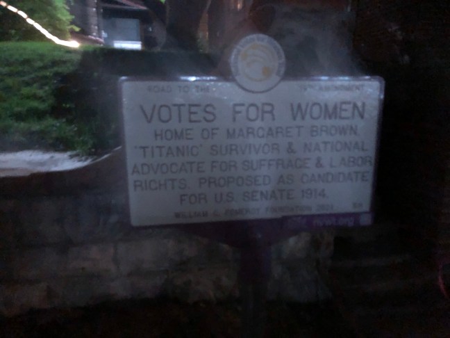
Women received the right to vote in Colorado in 1893. After this momentous occasion, Colorado suffragists strived to get women the right to vote on a national level. A member of this movement was Margaret “Molly” Brown, who became famous because she was a Titanic survivor, the doomed ocean liner that sunk in 1912.

She joined the Congressional Union for Woman Suffrage in 1914 and attended the suffrage convention in Rhode Island. Later, Brown was proposed as a U.S. Senate Candidate by the Congressional Union for Woman Suffrage. She was also involved with different labor issues and was part of the Red Cross in France during World War I.

The marker is part of the National Votes for Women Trail. It sits in front of the Molly Brown House Museum, which was Brown’s old home.

Historical Marker Description

Road to the 19th Amendment

Home of Margaret Brown, ‘Titanic’ survivor & national advocate for Suffrage & Labor Rights. Proposed as candidate for U.S. Senate 1914.

William C. Pomeroy Foundation 2021 58

Location

1320 North Pennsylvania Street, Denver, Colorado 80203, United States

39° 44′ 14.310″ N, 104° 58′ 51.720″ W

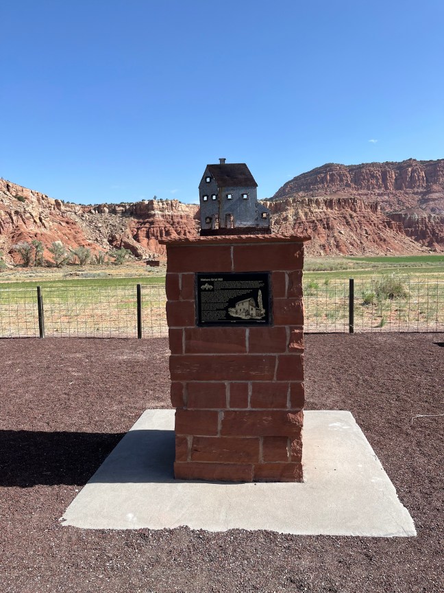
Nielsen Grist Mill Historical Marker, Utah

Nielsen Grist Mill, Teasdale, Utah Historical Marker

Located in Wayne County, Utah, the 120-year-old Nielsen Grist Mill is still standing. It is the only mill left in the state that still has the original water-powered equipment.

Built by Danish miller, Hans Peter Nielsen, in the late 1800s, it was a two and half story mill that operated until 1935. It was destroyed by fire in the late 1800s and rebuilt, and then it was remodeled in 1910.

The mill is currently being restored, and it is located on private property on Highway 24 west of Torrey, heading towards Capitol Reef National Park. It was listed on the National Register of Historic Places in 1975.

Historical Marker Inscription

The Nielsen Grist Mill is located at the foot of Thousand Lake Mountain on the edge of scenic country referred to by ancient Indians as “The Land of Sleeping Rainbow.” Constructed around 1893 for Hans Peter Nielsen by his son-in-law, Niels Hansen, the mill was known as the Thurber Rolling Mills. Water for powering the mill was channeled from the Fremont River and dropped 22 feet through a-wooden pipe to the turbine that ran the mill.

The mill still has a double stand of Wolf Rolls and two double stands of McNalley Rolls with scalpers under each that are spouted to the various elevator legs. Sixteen elevators with five reels for flour milling are found in the mill. The Barnard and Leas dust collector and turbine with belting still have pulleys made of native wood, ready for use. Old models of Howe Scales, one for weighing wheat and one for weighing flour sacks, still exist. All equipment is in good shape, including the cash register. The mill produced flour, germade, shorts, and bran, each coming from individual spouts.

Farmers would receive one sack of flour for each three sacks of wheat. All 48-pound bags of flour were sewn by hand. The space between the ears was sewn with a long, sharp needle with a built-in thread cutter.

The mill made flour for the surrounding area for 40 years. Improved roads, constructed in the 1930s, spelled the beginning of the end for the Thurber Rolling Mills. Since Wayne County could not grow hard wheat, which made the best bread, it became just as easy to truck in flour as hard wheat.

1999 No. 522 Camp Thurber

Location

SR-24, Teasdale, Utah 84773, United States

38° 18′ 25.350″ N, 111° 30′ 28.980″ W

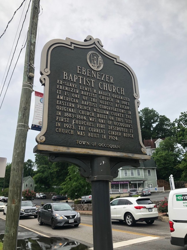
Ebenezer Baptist Church, Occoquan, VA

Ebenezer Baptist Church Historical Marker, Occoquan, VA

Founded by Lewis Bailey in 1883, who was born a slave in Virginia, the Ebenezer Baptist Church is one of the oldest African American Baptist in Eastern Prince William County. Bailey had been separated from his family before the start of the American Civil War. He had been sold to a Texas slave owner.

After the end of the war, he walked back to Northern Virginia so he could reunite with his family and organized the creation of the church.

The original church burned down in 1923. It was rebuilt in 1924.

Historical Marker Inscription

Ex-slave Lewis H. Bailey organized Ebenezer Baptist Church in 1883. It is one of the oldest African-American Baptist congregations in Eastern Prince William County. The original church, built on this site in 1883–1884, was one of Occoquan’s first churches. Fire destroyed it in 1923. The current cinder block church was built in 1924.

Town of Occoquan

Location

209 Washington Street, Occoquan, VA, 22125 United States

38° 40′ 58.260″ N, 77° 15′ 36.642″ W

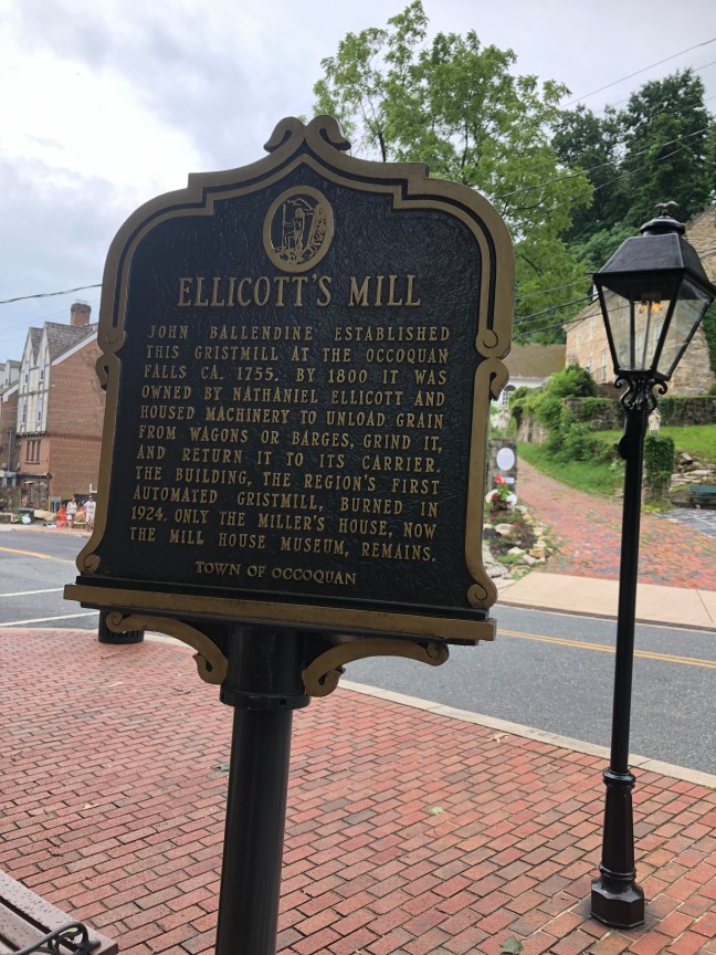
Ellicott’s Mill, Occoquan, Virginia

Ellicott's Mill, Occoquan, Virginia Historical Marker

In 1755, John Ballendine had purchased 20 acres of land in Occoquan Town, and he developed different commercial enterprises, including an iron works. By the end of the 18th century, Nathaniel Ellicott, a Quaker, buys what’s left of the iron works and turns it into a milling operation. It would become the first automated gristmill in the United States.

The mill would remain in operation until 1924. A generator fire in the Occoquan Electric and Power Company resulted in the destruction of the building. The Mill House, which had been connected to the mill, did survive, but it collapsed due to neglect.

The Mill House, however, would be restored in the 20th century, first for office space during the construction of the Occoquan dams and later as a museum. The Town of Occoquan owns the Mill House, and it is leased to the Occoquan Historical Society who runs the museum.

Historical Marker Inscription

John Ballendine established this gristmill at the Occoquan Falls ca. 1755. By 1800 it was owned by Nathaniel Ellicott and housed machinery to unload grain from wagons or barges, grind it, and return it to its carrier. The building, the region’s first automated gristmill, burned in 1924. Only the Miller’s House, now the Mill House Museum, remains.

Town of Occoquan

Location

River Mill Park, 458 Mill Street, Occoquan, VA, 22125 United States

38° 41′ 7.692″ N, 77° 15′ 43.842″ W