Blog

Tullis-Toledano House Historical Marker, Mississippi

Tullis-Toledano House Historical Marker, Biloxi, MS

The Tullis-Toledano Manor was once listed on the U.S. National Register of Historic Places. It was built around 1856 and was a red-clay brick Greek Revival home. The property also went by the name Toledano-Philbrick-Tullis House.

The property was built by Christoval Sebastian Toledano, who was a wealthy sugar and cotton broker in New Orleans of Spanish descent. The house was built as a vacation property for his second wife, Matilda Pradat. The property also included a servant’s quarter.

Matilda Toledano sold the home in 1886. It was sold a number of times before Garner H. Tullis of New Orleans bought it in 1939. Tullis was president of the New Orleans Cotton Exchange. He later sold the manor to the City of Biloxi in 1975 who used it as a museum and community center.

In 1969, the home had been damaged by Hurricane Camille. It was destroyed by Hurricane Katrina on August 29, 2005 when a barge was pushed ashore and reduced the property to rubble.

Historical Marker Inscription

One of the most substantial of the early vacation houses on the Gulf Coast, the Tullis-Toledano House was built in 1856 for New Orleans native Christoval Sebastian Toledano (1789-1869) and his wife, Matilda Pradat Toledano. The estate, composed of a Creole-influenced Greek Revival house, detached kitchen, servants quarters, and carriage house, was purchased by the Tullis family in 1939. Damaged during Hurricane Camille and later restored, the house was destroyed by Hurricane Katrina in 2005.

Mississippi Department of Archives and History, 2013

Location

30° 23′ 33.780″ N, 88° 52′ 10.002″ W

Beach Boulevard, Biloxi, MS 39530 United States

Lime Creek Burn 1879

Lime Creek Burn 1879 Historical Marker, Colorado

The Lime Creek fire burned 26,000 acres in 1879, which was a major drought year. The fire burned an area of the San Juan Mountains between Molas Pass and Coal Creek Pass, located along U.S. 550. The Ute Native Americans were blamed for the fire, which they supposedly lit for being pushed out of Colorado.

Since the area had been a drought, there were other fires that year. According to records, 1879 had less than half of the normal annual rainfall of the year, making it one of the driest years on record.

Historical Marker Inscription

This man-caused forest fire burned 26,000 acres consuming approximately 150,000,000 board-feet of timber. Reforestation by direct seeding and planting of seedling trees was started in 1911 and continues today.

The project was financed by federal funds and contributions from the conservation-minded Colorado Federation of Women’s Clubs.

Location

U.S. 550, CO 81433 United States (near the Post Office)

37° 42′ 54.960″ N, 107° 45′ 16.920″ W


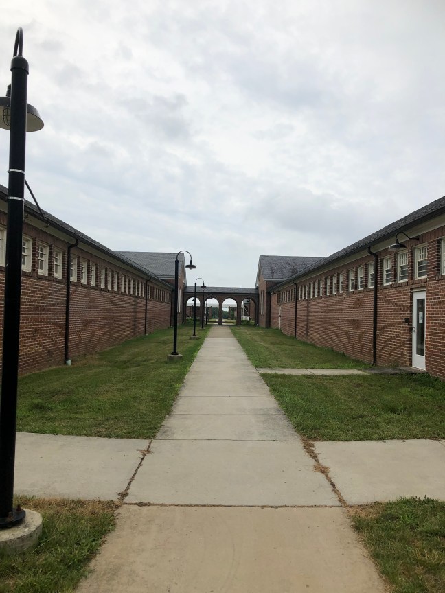
Occoquan Workhouse, Lorton, Virginia

Workhouse Arts Center Lorton, VA

Occoquan Workhouse Historical Marker, Lorton, VAThe historical marker commemorates the imprisonment of 70 suffragists during 1917. The women had been peacefully picketing on the White House sidewalk and were known as the Silent Sentinels.
The Washington, D.C., police arrested the women with the charge of obstructing traffic. They were given the choice of paying a $25 fine or going to jail. They refused to pay the fine since they considered it an admission of guilt. So, the women were jailed at the Occoquan Workhouse.

The suffragists were treated poorly at the workhouse, housed in rat-infested cells and given food that had maggots. They were forced to suffer physical and psychological violence.

On November 14, 1917, the superintendent of the workhouse told the guards that they could beat the suffragists. Then on November 15, 1917, 20 women were subject to severe assaults and torture. These included activists Lucy Burns and Dorothy Day. Many of the prisoners suffered severe repercussions. Alice Cosu had a heart attacked, and Dora Lewis was knocked unconscious.

Due to the brutality suffered, many consider this the turning point of the suffragist movement.

Historical Marker Inscription

In the nearby Occoquan Workhouse, from June to December, 1917, scores of women suffragists were imprisoned by the District of Columbia for picketing the White House demanding their right to vote. Their courage and dedication during harsh treatment aroused the nation to hasten the passage and ratification of the 19th Amendment in 1920. The struggle for woman’s suffrage had taken 72 years.

Location

9518 Workhouse Way Lorton, VA 22079 (intersection of Ox Road and Workhouse Way)

38° 41.839′ N, 77° 15.365′ W

Dobbin House, Gettysburg, Pennsylvania

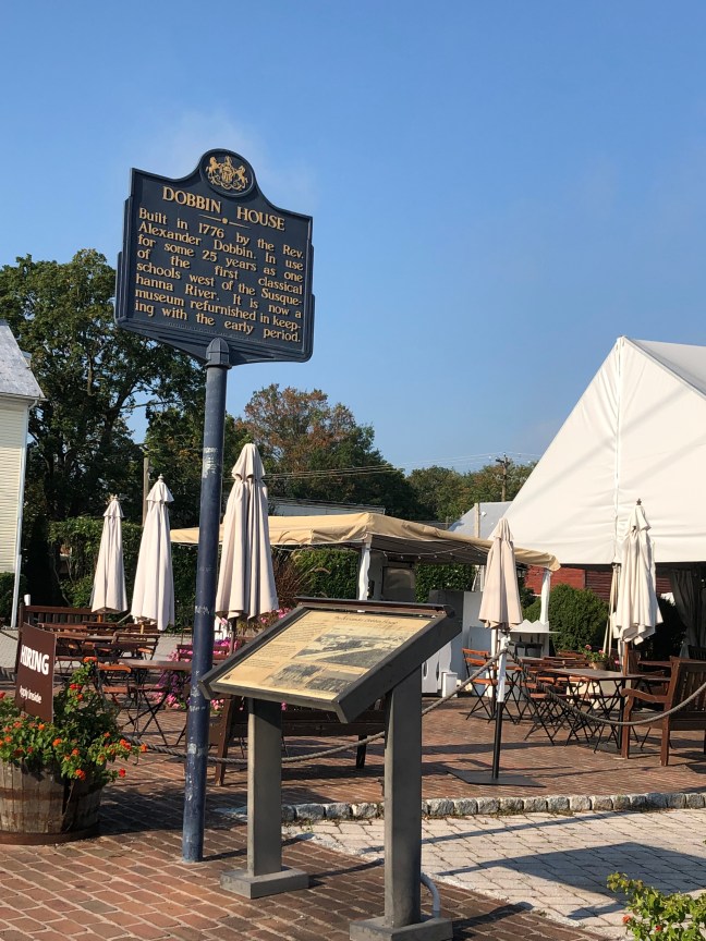
Dobbin House, Gettysburg, PA Historical Marker

Reverend Alexander Dobbin purchased 300 acres within Gettysburg and the surrounding areas in 1774. Dobbin was a Scots-Irish Presbyterian minister and educator. He became one of the most influential people in Gettysburg at the time.

Dobbin built the house in 1776 as both a house and a Classical School. The school taught a combination liberal arts and theology. It later became a part of the Underground Railroad for runaway slaves. It also was a hospital for Confederate and Union soldiers after the Battle of Gettysburg during the American Civil War.

It is the oldest structure in Gettysburg. The house is now a restaurant and tavern that is listed on the National Register of Historic Places.

Historical Marker Inscription

Built in 1776 by the Rev. Alexander Dobbin. In use for some 25 years as one of the first classical schools west of the Susquehanna River. It is now a museum refurnished in keeping with the early period.

Location

89 Steinwehr Ave, Gettysburg, PA 17325

39° 49.352′ N, 77° 13.951′ W


The Opelousas Post Militia of 1779, Opelousas, Louisiana

The Opelousas Post Militia of 1779 Historical Marker

This marker recognizes the contribution of the volunteer Opelousas citizen militia. During 1779, the militia took action in Baton Rouge against the British. The Opelousas militia marched across swamps and marshes to eventually join the Spanish Governor, General Bernardo de Galvez. The goal was to defend Baton Rouge and to keep the British from controlling the lower Mississippi River, especially the area between Natchez and New Orleans.

The militia left Fort Hamilton in the east of Opelousas in groups, heading towards Baton Rouge. They had to content with everything from snakes to alligators to the marshy areas.

Many of the last names of the members would be familiar with anyone from Louisiana, especially St. Landry Parish. These include Bertrand, Brignac, Dupre, Lafleur, Prudhomme, Richard, Trahan and more.

Historical Marker Inscription

In late August of 1779, men of the Opelousas Post Militia left from this place to join other militia units to attack British forces in the lower Mississippi Valley. They crossed the Atchafalaya swamp to join Brig. General Bernardo de Gálvez, the Governor of the Spanish province of Louisiana. The O.P.M. met him at Fort San Gabriel a few miles below present-day Baton Rouge. Total forces under Gálvez numbered 175 Spanish army veterans, 330 Spanish recruits, 80 free men of color, 160 Choctaws, plus about 600 men from various militias along the Mississippi River and from throughout the far-flung posts of civilization in Louisiana. On September 22, 1779, Gálvez’s effective forces, numbering less than 900, laid siege to and captured Ft. New Richmond at Baton Rouge. This victory forced the surrender of Ft. Panmure at Natchez, British headquarters in the lower Mississippi Valley. This generally unknown military action in American history in which the Opelousas Post Militia took part greatly aided in the winning of the American Revolution of 1775-1783.

Location

Le Vieux Village, 828 East Landry Highway, Opelousas LA 70570, United States

30° 31.906′ N, 92° 4.432′ W

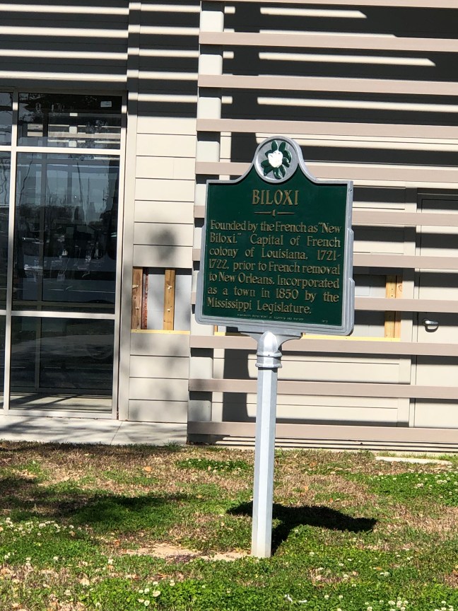
Biloxi, Mississippi Historical Marker

Biloxi, MS Historical Marker

From as early as 8,000 BC to the 1700s, Native Americans made Biloxi home. Then, in 1697, the Comte de Ponchartrain, French Minister of Marine, ordered Pierre Le Moyne, Sieur d’Iberville, to find the mouth of the Mississippi River. In the course of looking for it, Iberville and 14 men came to what would become Biloxi, named after the Biloxi Native Americans, who the crew met and befriended. These Native Americans might have only arrived at the coast a short while before the French.

Biloxi became the capital of the French territory from about 1719 to 1722 when the capital was moved to New Orleans. By 1779, the French had ceded the Mississippi Coast to Spain, and it briefly (in 1810) became a part of the Republic of West Florida. In fact, over the years, Biloxi was under the French, Spanish, British, West Florida Republic, Confederacy and the United States flags.

Mississippi officially became a state in 1817. By 1850, Biloxi was incorporated as a township and became a favorite summer resort.

Historical Marker Inscription

Founded by the French as “New Biloxi.” Capital of French colony of Louisiana, 1721-1722, prior to French removal to New Orleans. Incorporated as a town in 1850 by the Mississippi Legislature.

Location

Biloxi Small Craft Harbor, 679 Beach Boulevard, Biloxi, MS 39350 United States

30° 23′ 33.372″ N, 88° 53′ 3.840″ W

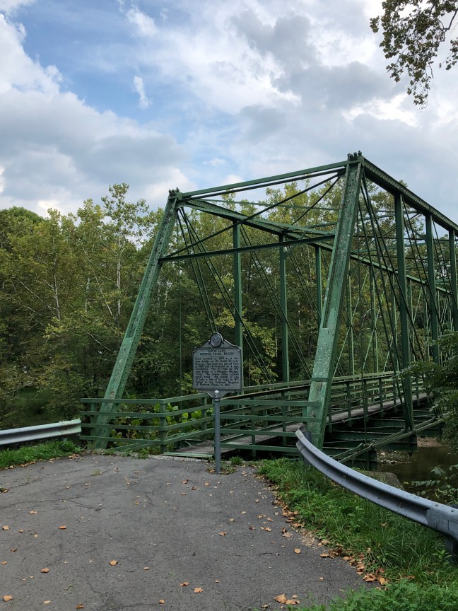
Capon Lake Whipple Truss Bridge, West Virginia

Capon Lake Whipple Truss Bridge, WV

The Capon Lake Whipple Truss Bridge was built in 1874 to replace a wooden-covered bridge. The former bridge had been destroyed during the Civil War by Confederate soldiers.

The bridge was built by T.B. White and Sons using the Whipple truss, which was created by Squire Whipple and patented in 1847.  It was a stronger version of the Pratt truss and was known as the “Double-intersection Pratt” due to the fact that the diagonal tension members crossed two panels as opposed to the one used in the Pratt design. It typically had a trapezoidal look. Because it was stronger and firmer than the original design, it was embraced by the railroads.

The Capon Lake Whipple Truss Bridge is West Virginia’s oldest extant metal truss. It stopped being used in 1991 after the construction of a new bridge. It was added to the National Register of Historic Places in 2011.

Historical Marker Inscription

First erected in 1874 as a two span bridge on US Route 50 near Romney, one span was moved here in 1938 and re-erected on a new foundation. the 17′ wide by 176′ long bridge is a Whipple-Murphy Truss. The state’s oldest extant metal truss, the bridge is one of only a few of its type in WV. Listed in the National Register of Historic Places in 2011.

Location

10001-10099 Carpers Pike, Yellow Spring, West Virginia 26865 United States

39° 9′ 32.150″ N, 78° 32′ 5.820″ W

Mosby’s Rock Historical Marker, Herndon, Virginia

Mosby's Rock, Herndon, VA

Known as the “Gray Ghost”, John S. Mosby was part of the Confederate Army’s 43rd Virginia Cavalry Battalion during the American Civil War. Known as a rabble-rouser, he was head of a partisan ranger unit that was known by several names, including Mosby’s Raiders, Mosby’s Men and Mosby’s Rangers.

The unit was renown for its raids on Union targets and ability to evade capture. During the course of the war, Mosby’s Raiders were able to disrupt Union communications, supply lines and outposts.

A spy working for Mosby, Laura Ratcliffe, in 1863 recommended using a large rock (located in Herndon, VA) as a meeting place where the soldiers could meet after doing raids. Ratcliffe also hid money and messages under the rock, the latter which Mosby credited with helping him escape from capture by Union soldiers.

While Mosby did daring deeds during the Civil War, he was held in contempt by many of his fellow Virginians after the war. He admitted that the Confederacy had lost the war while many others still believed in the “Lost Cause” myth. This myth revolves around the belief that the South was in the right and heroic, and it tries to paint the antebellum South in the best light.

The rock is still there, but it borders a subdivision. Since 2020, the marker on the rock has been missing. It was said to read as follows: “Mosby’s Rangers (43d Bn., Va. Cav.) used this rock as a rendezvous point and met here to divide the spoils after raids. The renowned Southern spy and scout Laura Ratcliffe, who lived nearby, showed this rock to Col. (then Captain) John S. Mosby, CSA, in 1863, and suggested he use it as a meeting place”.

Historical Marker Inscription

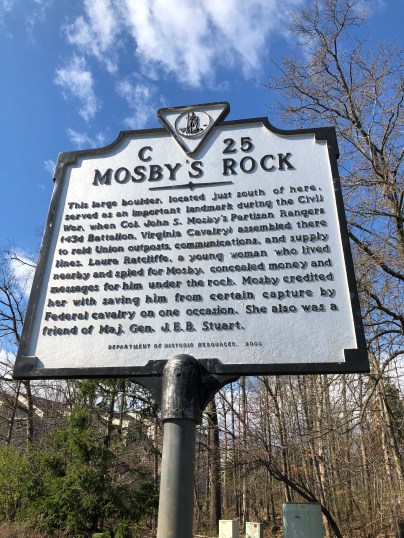
Mosby's Rock Historical Marker

This large boulder, located just south of here, served as an important landmark during the Civil War, when Col. John S. Mosby’s Partisan Rangers (43rd Battalion, Virginia Cavalry) assembled there to raid Union outposts, communications, and supply lines. Laura Ratcliffe, a young woman who lived nearby and spied for Mosby, concealed money and messages for him under the rock. Mosby credited her with saving him from certain capture by Federal cavalry on one occasion. She also was a friend of Maj. Gen.  J.E.B. Stuart.

Location

13570 Big Boulder Road, Herndon, Virginia, 20171 United States

38° 56′ 47.340″ N, 77° 24′ 57.000″ W

Boggsdale, Long Beach, Mississippi

Boggsdale, MS Historical Marker

Boggsdale is the area of the family home of Thomas Hale Boggs, the late U.S. Congressman from Louisiana who died in a plane crash in Alaska on December 29, 1972.

Seven acres of beachfront property was purchased by Georgian artist and writer, Robert Boggs, and wife, Eliza Jane, in 1875. The area would eventually become Long Beach. The house they built was named Breezydale. According to legend, Native Americans warned the family not to build so close to the Sound.

The property was inherited by the couple’s son, William, and wife, Claire Hale. The other son, Archibald, and his wife, Bessie, were given adjacent land. They built a home by the name of Driftwood, which was named after lumber that had washed ashore.

A major hurricane in 1947 destroyed both homes and killed Bessie. Breezydale was rebuilt 600 feet back from the water and was named Will-Stan, but that property was also destroyed during Hurricane Camille in 1969.

Hale Boggs had plans of rebuilding on Boggsdale before his plane disappeared in Alaska.

Historical Marker Inscription

Thomas Hale Boggs (1914-1972). U.S. Congressman from La. for 28 years, was born in the family home built on this site in 1875. The son of Wm. & Claire Hale Boggs, Rep. Boggs served as House Majority Leader, 1971-72.

Location

30° 20.291′ N, 89° 10.154′ W

Beach Boulevard West (intersection of Boggs Drive and U.S. 90), Long Beach, MS 39560

Our Lady of Prompt Succor Cemetery No. 1

Our Lady of Prompt Succor Cemetery No. 1 Historical Marker

St. Joseph Parish in Westwego, located on the West Bank of New Orleans, was established in 1857. It was the main church for Jefferson Parish on this side of the river. The parish grew a few years later due to the dramatic growth of the population of Westwego after the hurricane of 1893. Before land was acquired, mass was often celebrated in residents’ homes.

On February 23, 1905, land was donated by 12 men known as “The 12 Apostles” to the St. Joseph Church in Gretna. The lot was located on Laroussini Street and was 100 feet by 320 feet.

On June 7, 1906, a new chapel known as the Church of Our Lady Prompt Succor was dedicated on the north side of the site. A cemetery was added to the south side of the lot and became known as Cemetery No. 1.

Historical Marker Inscription

The land for this cemetery was part of a parcel sold in 1902 by Alphonse A. Lelong to a group called “The 12 Apostles” of Catholic Life Westwego. They were Hypolite Eloi, Victorin A. Pitre, Ernest Lefort, Andre Curol, Leo Decuers, Adrien Ortiz, Adrien Curol, Victor Arnaudin, J. Dupre Terrebonne, Felicien Sandras, Leodgard Pitre, and Edouward PItre. They donated the land to St. Joseph’s Parish in Gretna for the first chapel and cemetery in Our Lady of Prompt Succor Parish, Westwego. Their heirs donated it to OLPS in 1932.

Location

Our Lady of Prompt Succor & Holy Guardian Angels Catholic Church, 146 Fourth Street, Westwego, LA, 70094

29.909547579819836, -90.14553436006213