Blog

Escalante Canyon Historical Marker, Delta, CO

Escalante Canyon Historical Marker, Delta, CO

Escalante Canyon is a beautiful and historical canyon located near Delta, Colorado. The canyon is named after two Franciscan priests, Silvestre Vélez de Escalante and Atanasio Domínguez. They were part of expedition that happened in 1776 to find an overland route between Santa Fe, New Mexico, and a Roman Catholic mission in Monterey, California. While the priests didn’t actually pass through the canyon, it is still named after Escalante.

The canyon was formed over 600 million year ago and is a 1,300 foot deep gorge, carved by the Escalante Creek. The canyon features petroglyphs that trace back to the earliest people. It is known that the Ute Indians made the North Fork of the Escalante River their winter home, and early settlers eventually moved in to take advantage of the easy water supply, forcing many natives off their lands. Cattle outfits also began using the canyon in the late 1800s.

Escalante Canyon was a notable part of the Colorado Sheep War as well. The Spanish had introduced sheep into America, and their numbers had increased to over 2 million by 1896. Some settlers also brought sheep with them when the area was opened to settlers in 1882. With the rise of cattle in the region, conflicts between two sides for grazing lands was inevitable.

Cattle owners would threaten sheep owners by wearing masks. These marauders eventually became known as the Night Riders. In 1915, the Night Riders attacked at a band of sheep in the Oh-Be-Joyful Creek area. They drove a herd of 200 sheep of a cliff while the owner was tied to the tree. Then, on June 9, 1917, Ben Lowe and a former local Delta County sheriff, Cash Sampson, died during a shootout, each falling to the other’s gun.

The two had supper at J.W. Musser’s ranch. When they were leaving, they got into an argument that left both men dead only a few feet apart. While there were no witnesses to the argument, it is very likely that it was due to Sampson investigating Lowe as being part of the sheep slaughter than had taken place previous year.

Within the canyon, you can find the stone cabin of Captain Henry A. Smith, who was a Civil War veteran. He used local sandstone to build his cabin and made his living as a tombstone carver. The cabin is located 18 miles from the Escalante Bridge.

Historical Marker Inscription

Named after one of the two priests Escalante and Dominguez after their expedition in 1776. Rich in history this canyon has seen its share of human beings starting with the earliest Native Americans since circa 700 AD. After the Civil War, Captain Henry A. Smith, a tombstone carver, made this canyon his home. The canyon hosted the Colorado Sheep War during March 1916 and a shootout left residents Cash Sampson and Ben Lowe dead.

The previous plaque was dedicated June 12, 2003.

This plaque rededicated July 17, 2010 by Al Packer Chapter 100

E Clampus Vitus

Location

US-50 E, Delta, CO 81416

38° 47′ 2.760″ N, 108° 14′ 47.970″ W
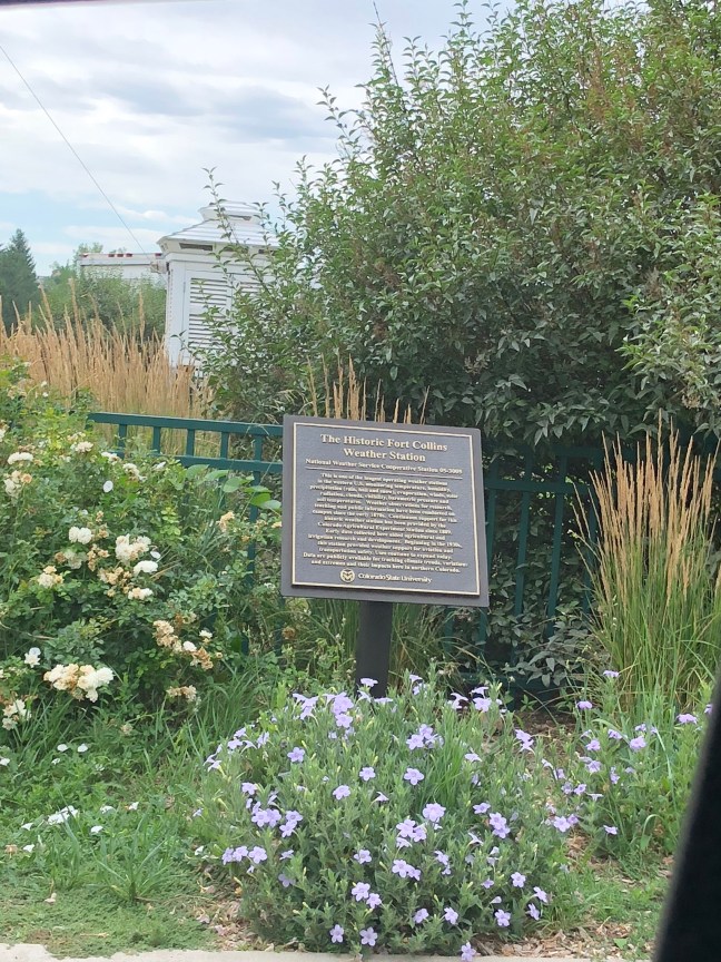
The Historic Fort Collins Weather Station

The Historic Fort Collins Weather Station Historical Marker

Located on the campus of Colorado State University near the Lory Student Center, the Historic Fort Collins Weather Station began collecting data in the 1870s. It was located near the site of the “Old Main” building, which was lost to arson in 1970.

Data is available in both digital and hard copy forms dating back to 1889, and data is updated every 10 minutes. This data includes information about humidity, wind speeds and direction, temperature, pressure, soil temperatures and solar radiation.

Colorado State University

Historical Marker Inscription

This is one of the longest operating weather stations in the western U.S. monitoring temperature, humidity, precipitation (rain, hail and snow), evaporation, winds, solar radiation, clouds, visibility, barometric pressure and soil temperatures. Weather observations for research, teaching and public information have been conducted on campus since the early 1870s. Continuous support for this historic weather station has been provided by the Colorado Agricultural Experiment Station since 1889. Early data collected here aided agricultural and irrigation research and development. Beginning in the late 1930s, this station provided weather support for aviation and transportation safety. Uses continue to expand today. Data are publicly available for tracking climate trends, variations and extremes and their impacts here in northern Colorado.

Location

Colorado State University, Fort Collins, CO 80523

40° 34.582′ N, 105° 5.158′ W

St. Mary’s German Catholic Parish Historical Marker

St. Mary's German Catholic Parish, Sandusky, OH

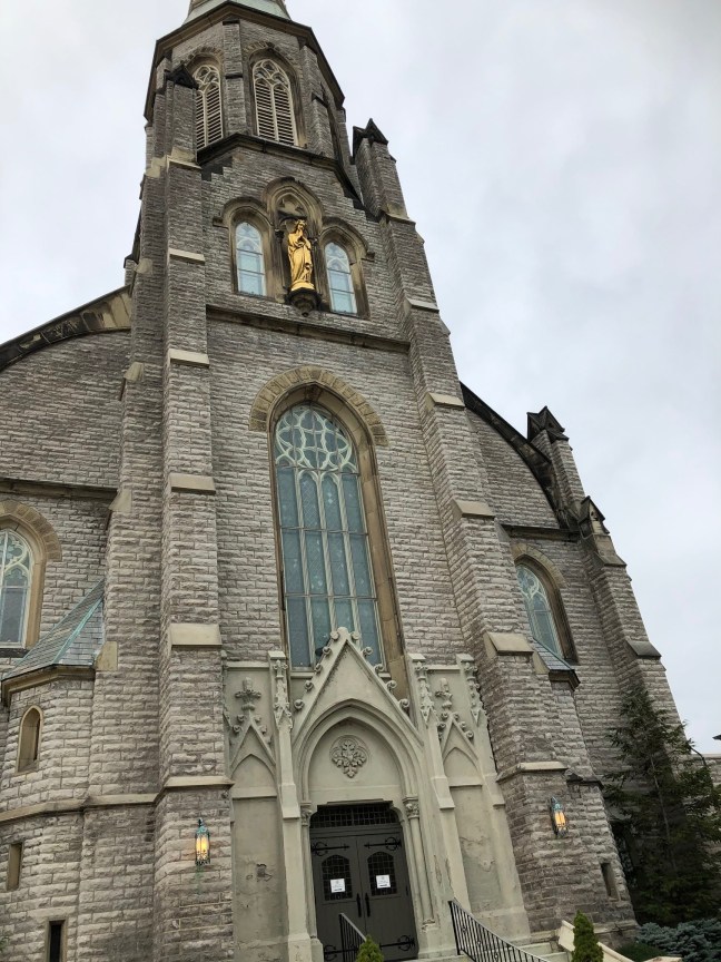
St. Mary’s Catholic Church was founded by German immigrants who had been worshiping at Holy Angels. Holy Angels had been originally comprised of both English and German immigrants, but the German immigrants broke off from the English group to form their own congregation and the second Catholic Parish in Sandusky, OH. The property for the parish was purchased on June 20, 1855. The original church itself was finished in 1856.

Originally, the Germans who had come to America were led by Father John P. Dolweck, who had been appointed by the Right Reverend Louis Amadeus Rappe, Bishop of the Diocese of Cleveland. He was succeeded by Father James J. Hamene. He helped complete the first church and rectory.

By 1857, St. Mary’s also had a school. In 1873, the parish began building a new church under the direction of Father Nicholas Moes, who hired Franz George Himpler to oversee the construction. Seven years later the new church was completed and dedicated to Mary, Mother of Sorrows. It is the largest church in the City of Sandusky.

St. Mary's German Catholic Parish, Sandusky, OH Historical Marker

Historical Marker Inscription

Side A:

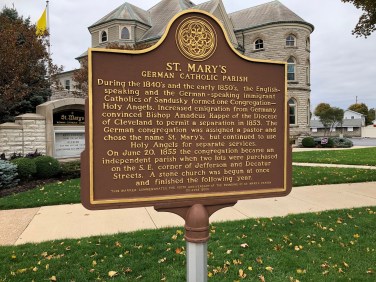
During the 1840’s and the early 1850’s, the English-speak and the German-speaking immigrant Catholics of Sandusky formed on Congregation – Holy Angels. Increased emigration from Germany convinced Bishop Amadeus Rappe of the Diocese of Cleveland to permit a separation in 1853. The German congregation was assigned a pastor and chose the name St. Mary’s, but continued to use Holy Angels for separate services.

On June 20, 1855 the congregation became an independent parish when two lots were purchased on the S.E. corner of Jefferson and Decatur Streets. A stone church was begun at once and finished the following year.

This marker commemorates the 150th anniversary of the founding of St. Mary’s Parish

20 June 2005

St. Mary's German Catholic Parish, Sandusky, OH Historical Marker

Side B:

Architect: Francis George Himpler – 1833-1916

In 1867 six lots on Central Avenue and on Fulton Street were purchased as the site for a new and larger church. The architect based his plans for St. Mary’s on the first pure Gothic ecclesiastical structure in Germany the ELISABETHKIRCHE in Marburg. Begun in 1235 A. D. by the Knights of the Teutonic Order, the church was for centuries a pilgrimage site to the tomb of St. Elizabeth.

The cornerstone for the new St. Mary’s was laid on Sept. 28, 1873. Seven years later it was completed. On Nov. 28, 1880 Bishop Richard Gilmour, D. D. of the Diocese of Cleveland dedicated the church to Mary, the Mother of Sorrows.

The dimensions are: 76 feet wide by 184 feet long.

The spire is 200 feet high.

This marker commemorates the 125th anniversary of the dedication of the church

28 September 2005

Location

429 Central Ave, Sandusky, OH 44870

41.45231960171621, -82.7138909

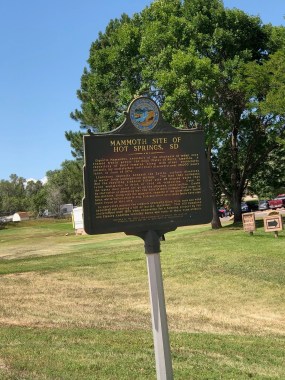
The Mammoth Site of Hot Springs, SD, Historical Marker

Mammoth Site Hot Springs, SD

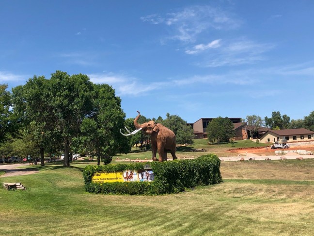
The Mammoth Site in Hot Springs, South Dakota, is an active dig site that allows visitors to view different fossils from the Ice Age, mainly mammoth, including tusks and skulls. The Mammoth Site was discovered in June 1974 when heavy equipment operator, George Hanson, began leveling ground to build a housing development. While grading a hill, Hanson discovered a tusk and other bones.

Phil Anderson, the landowner, contacted several universities to see if they were interested in seeing the find. All declined. George Hanson instead took the bones to his son, Dan Hanson, who had taken classes in archaeology and geology. He then called his former college professor, Dr. Larry Agenbroad, who later contacted Dr. Jim Mead.

Mammoth Site, Hot Springs, South Dakota

In 1975, Dr. Agenbroad and Dr. Mead along with volunteer students started excavating the area. What they found was a massive mammoth graveyard due to an ancient sink hole (animals would come to drink or eat at the location, fall in and couldn’t escape due to the steep, slippery sides). By the end of 1975, realizing that the area was of major interest to science, Phil Anderson along with the local community founded The Mammoth Site of Hot Springs, SD, Inc.

There is a fee to enter the active dig site.

Historical Marker Inscription

Mammoth Site, Hot Springs, SD, Historical Marker

Gigantic mammoths, ancestors of the majestic elephants of today, once roamed freely across the High Plains of North America. A repository of their remains, along with other kinds of animals, lay undisturbed until their discovery over 26,000 years later, in June of 1974.

Limestone deposits beneath the earth’s surface dissolved in water from underground springs. The land then collapsed and the resulting sinkhole filled with 95 degree water that lured mammoths to drink or feed on vegetation. Once in the water they could not get up the slippery, steep incline. Death by starvation or drowning was the fate of most animals that came to the sinkhole. Along with the mammoth, remains of the giant short-faced bear, white-tailed prairie dog, fish and other associated fauna have also been found at the site.

As centuries passed, the sinkhole gradually filled. Rain, snow and wind wore away the soil leaving a hill of buried skeletons. This hill remained undisturbed until 1974 when excavation for a housing project by Phil and Elenora Anderson revealed bones and tusks of these huge animals.

Location

1800 US 18 Bypass, Hot Springs, South Dakota 57747
N 43° 25.370 W 103° 29.028

Andrew Bryan – Savannah, GA, Historical Marker

Andrew Bryan - Georgia Historical Markers

Andrew Bryan was born in 1737 on a plantation in Goose Creek, South Carolina, which is near Charleston. Born a slave, he served as a coachman and body servant for Jonathan Bryan. Jonathan Bryan, his brother Hugh and a number of other planters had been arrested for preaching to slaves. They had been part of a group of plantation owners who had been trying to evangelize to the slaves.

Andrew become a Baptist in 1782, converted by George Liele, who was the first black Georgian Baptist. Both Andrew and his wife, Hannah, were baptized by Liele. Andrew continued to preach to small groups near Savannah even after Liele left the area.

Andrew was supported by the planters, and he wound up building a shack for his flock, which even included a handful of white people. Still, there were a number of masters who refused to allow their slaves to be baptized. And, many Georgian masters forbade their slaves to listen to sermons by Andrew due to fears of uprisings and desertions. Many of the slaves who attended the sermons were imprisoned, harassed and whipped. Even Andrew was imprisoned. When released, Bryan’s masters allowed him to continue preaching on a barn on the property.

In 1788, a white minister by the name of Abraham Marshall officially recognized Andrew’s small flock. He baptized more than 40 members of the group and ordained Andrew. After Jonathan Bryan died, Andrew Bryan purchased his freedom and raised money to erect a church in Savannah, Georgia, in 1794.

Starting with 575 members in 1788, the First African Baptist Church grew to nearly 2,800 members in 1831. By 1800, there were two satellite churches.

Andrew died on October 12, 1812, and he is buried in Savannah’s Laurel Grove Cemetery.

Historical Marker Inscription

Andrew Bryan was born at Goose Creek, S.C. about 1716. He came to Savannah as a slave and here he was baptized by the Negro missionary, the Reverend George Leile, in 1781. Leile evacuated with the British in 1782 at the close of the American Revolution and Bryan took up his work. He preached at Yamacraw and Brampton Plantation. On January 20, 1788, the Reverend Abraham Marshall (White) and the Reverend Jessie Peter (Colored) ordained Andrew Bryan and certified the congregation at a Brampton barn as the Ethiopian Church of Jesus Christ.

The Reverend Bryan moved from place to place with his congregation and was even imprisoned and whipped for preaching during a time when whites feared any slave gathering as a focus for rebellion. He persevered and finally bought his and his family’s freedom and purchased this lot for his Church. Andrew Bryan pastored until his death, October 6, 1812. He is buried in Savannah’s Laurel Grove Cemetery.

Location

The marker lies within the Yamacraw Square Park, which is located across the street from the First Bryan Baptist Church
565 West Bryan Street, Savannah, GA 31401

N 32° 04.937 W 081° 05.934

Site of St. Andrew’s Hall

St. Andrew's Hall Historical Marker

The St. Andrew’s Society was founded in Charleston, South Carolina, on November 30, 1729. Currently active, it is a social organization founded by men who were mainly of Scottish descent, but membership wasn’t limited to Scottish descendants. The purpose of the organization was to celebrate St. Andrew’s Day.

During the 1700s, the organization was extremely popular, and membership grew to include many of South Carolina’s most prominent people, including lawyers, planters, merchants and more. Through dues, gifts, admissions fees and bequests, it generated a substantial revenue and, through these, provided relief to the poor.

Officially incorporated in 1798, it opened a school for the poor on January 9, 1804, and began constructing its own hall in 1814. The hall was completed in 1815.

Throughout its history, the hall hosted many events, including social activities as well as being the meeting place for the Secession Convention. As the first state to secede from the Union, the Ordinance of Secession was officially passed at St. Andrew’s Hall on December 20, 1860.

The building burned on December 11, 1861, which was part of The Great Fire of 1861. This fire burned throughout Charleston, destroying vast extents of the city.

St. Andrew's Hall Historical Marker

Historical Marker Inscription

Site of the St. Andrew’s Hall
Designed by Hugh Smith
for
the St. Andrew’s Society of Charleston, S.C.
founded in 1729,
the oldest benevolent organization in the
State of South Carolina
corner stone laid July 4, 1814,
building destroyed by fire December 11, 1861.

Here such societies as the South Carolina Jockey Club, the St. Cecilia society, and the Hebrew Benevolent Association also held their meetings: Here President James Monroe and the Marquis de Lafayette were lodged as guest of the city; and here on December 20, 1860, was passed the South Carolina Ordinance of Secession.

Jonathan Jasper Wright Law Office

Jonathan Jasper Wright Law Office Historical Marker

From 1879 until 1885, a two-story stucco building that was built around 1876 served as the law office for Justice Jonathan Jasper Wright. He was the first African American State Supreme Court Justice.

Wright’s parents were slaves that had escaped to Springville, Pennsylvania. Wright was born on February 11, 1840, and studied law at the Lancasterian Academy in Ithaca, New York. In 1866, he passed the Pennsylvania bar exam.

At the end of the Civil War, he first traveled to Beaufort, South Carolina, to teach newly freed slaves. Wright began practicing law in South Carolina in the late 1860s and was elected to the Supreme Court of South Carolina as an Associate Justice in 1870.

He eventually resigned from the court in 1877. He did this in protest of the election of Governor Wade Hampton III in 1877, a campaign that was marked by violence and known for suppressing black votes in parts of the state by Hampton supporters known as “Red Shirts”. This year was also the end of Reconstruction as federal troops were removed from the South, and Jim Crow laws began reversing much of the gains made by African Americans during the previous time period.

In 1879, Wright opened his law office at 84 Queen Street. He died on February 18, 1885 and is buried at the Calvary Episcopal Church cemetery.

Historical Marker Inscription

Jonathan Jasper Wright Law Office Historical Marker

Front:

Jonathan Jasper Wright (1840-1885), the first African American in the U.S. to sit as a justice on a state supreme court, practiced law here from 1877 until his death in 1885. Wright, a native of Pa., was educated at Lancasterian Academy in Ithaca, N.Y. He came to S.C. in 1865 as a teacher for the American Missionary Association and was later a legal advisor to freedman for the Freedmen’s Bureau.

Back:

Wright wrote that he hoped to “vindicate the cause of the downtrodden.” He was a delegate to the S.C. constitutional convention of 1868 and a state senator from 1868-70. Wright, elected to the S.C. Supreme Court in 1870, resigned in 1877 due to political pressure. After he left the bench he practiced law, helped Claflin College found its Law Department, and became is Chair in Law. He died or tuberculosis in 1885.

Location:

84 Queen Street, Charleston, SC 29401
32.77817277207629, -79.93254871534323

Old Spanish Trail North Branch

Old Spanish Trail North Branch: Colorado Historical Marker

From about 1830 to 1848, the Old Spanish Trail was used to bring textiles from Santa Fe to Los Angeles, which were then traded for mules and horses for the New Mexico and Missouri markets. The trail is considered to be one of the most difficult trails in the United States.

Originally part of ancient, Native American Indian trade routes (one part of which was in use for nearly 1,000 years), the trade routes were connected later by Spanish, Mexican and American traders.

The trail was divided into two routes: the North Branch went north into the San Luis Valley in Colorado, which then went west over Cochetopa Pass, following the Gunnison and Colorado Rivers. It eventually connected with the South Branch near the Green River. The South or Main Branch went northwest to Green River, Utah, passing the Colorado San Juan mountains.

There have been many efforts over the years to preserve the Old Spanish Trail and make it part of the National Historic Trails system.

Historical Marker Inscription

This sign marks an important junction of the Old Spanish Trail. Both forks, east and west, of the North Branch of this Trail converged at Saguache before continuing west of Cochetopa Pass and on to Los Angeles.

The Old Spanish Trail was the principle mule pack route for explorers and traders until 1848, evolving into a wagon road and currently a modern highway.

The purpose of this sign is twofold: first, to note the 4th Annual Conference of the Old Spanish Trail National Association that convened at Saguache, Colorado on June 21-22, 1997; and second, to celebrate the vital contribution of the early trails, before which, all life was limitation.

Location:

Located in Saguache, Colorado, at the intersection of 8th Street (Highway 285) and Christy Avenue in a park.

38° 5.132′ N, 106° 8.527′ W.


Old Sandusky Post Office

Old Sandusky Post Office in Ohio

On a corner near the heart of Sandusky, Ohio, a town founded in 1817, sits the old post office. Located on Jackson Street, this imposing Neoclassical structure served as the third post office for the town. The first post office in the town was built in 1820 on Water Street.

While traveling to get mail from the post office was common during the early years, on December 1, 1882, Sandusky began offering free mail delivery. As the needs of the town grew so did the need of a larger post office, which was why the new one was built on the corner of West Washington and Jackson Street between 1925 and 1927. This one took the place of a smaller post office that had been located at Columbus Avenue and Market Street.

Located at the highest point above sea level in Sandusky, this building served as the main post office for 60 years. Besides the post office, the building also housed the National Weather Service, U.S. Customs, FBI and armed forces recruiting.

This location also became too small, and the post office was once again moved to a new space (2220 Caldwell Street) in 1986. Now, the old post office is home to the Merry-Go-Round Museum, which has occupied the space since 1990.

Historical Marker Inscription

Old Sandusky Post Office Historical Marker

The U.S. Post Office building, Sandusky’s third, opened in 1927, replacing the smaller building at Columbus Avenue and Market Street. It is notable for its fine Neoclassical-style architecture and its unusual curved portico. It was added to the National Register of Historical Places in 1982. For sixty years it served as Sandusky’s business center, where merchants shipped and received goods and banks transferred money. During this time it also housed offices for several federal agencies, including U.S. Customs, the National Weather Service, armed forces recruiting, and the Federal Bureau of Investigation. The U.S. Geological Survey disk embedded in the front steps serves as a benchmark for surveyors and scientists. Closed in 1987, the historic Sandusky Post Office building reopened as a museum in 1990.

The Ohio Bicentennial Commission, The Longaberger Company
Huron City Schools
The Merry Go Round Museum
The Ohio Historical Society
2001

Location:
301 Jackson St, Sandusky, OH 44870
41.4539° N, 82.7129° W

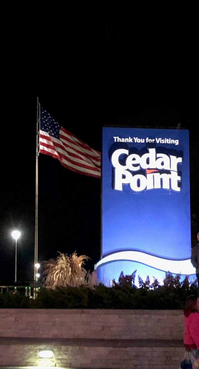
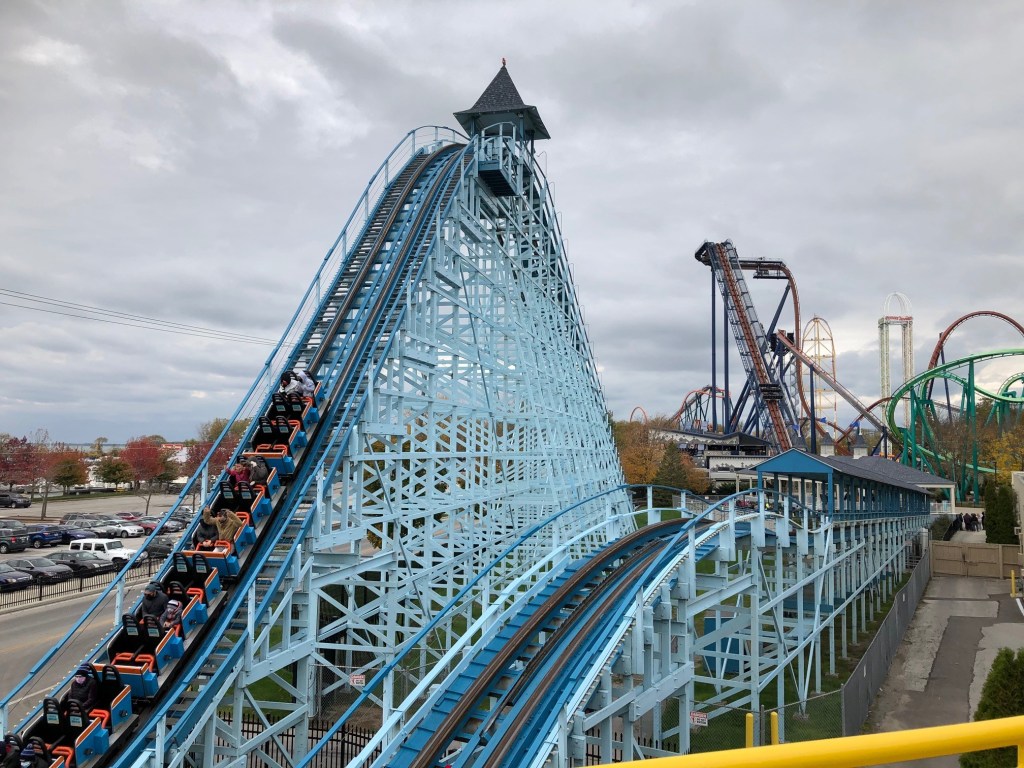
Cedar Point, Sandusky, Ohio

Cedar Point, Sandusky, OH

Located on a peninsula in northern Ohio, Cedar Point sits right on the banks of Lake Erie, one of the Great Lakes. Best-known for the amusement park that holds the same name, the location was originally a site for a lighthouse and a fisherman’s port. By 1867, the peninsula became part of a small railroad line, allowing developers to build attractions, including picnic areas and bath houses. The first official season of the amusement park was 1870 when different forms of entertainment was introduced.

But the reason why this amusement part is so famous actually came later in 1892 when the first roller coaster – the Switchback Railway – was built. The park went through many changes, including being purchased by the Cedar Point Pleasure Resort & Company, which opened new rides and offered overnight accommodations. In 1954, part of the area become a bird sanctuary. By 1965, the park had begun drawing more than two million visitors.

Since then, the park has steadily grown, and it has become known as the “Roller Coaster Capital of the World” and has held numerous roller coaster world records.

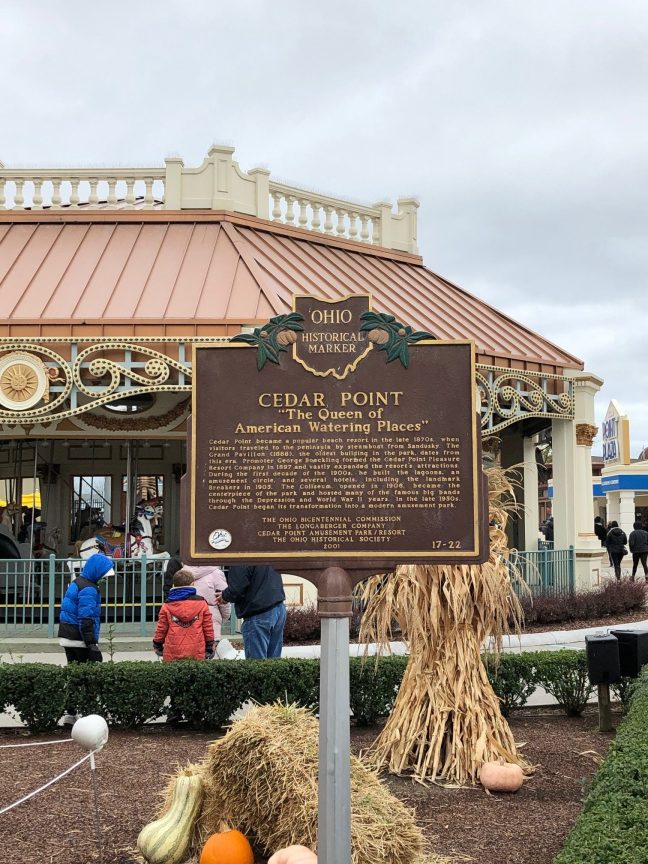
Historical Marker Inscription

Cedar Point Amusement Park Historical Marker

Cedar Point
“The Queen of American Watering Places”

Cedar Point became a popular beach resort in the late 1870s when visitors traveled to the peninsula by steamboat from Sandusky. The Grand Pavilion (1888), the oldest building in the park, dates from this era. Promoter George Boeckling formed the Cedar Point Pleasure Resort Company in 1897 and vastly expanded the resort’s attractions. During the first decade of the 1900s, he built the lagoons, an amusement circle, and several hotels, including the landmark Breakers in 1905. The Coliseum, opened in 1906, became the centerpiece of the park and hosted many of the famous big bands through the Depression and World War II years. In the late 1950s, Cedar Point began its transformation into a modern amusement park.

The Ohio Bicentennial Commission
The Longaberger Company
Cedar Point Amusement Park/Resort
The Ohio Historical Society
2001

Location:
1 Cedar Point Dr, Sandusky, OH 44870
41.4822° N, 82.6835° W