Located near the Haystack Mountains and the North Platte River, Guernsey, Wyoming, was originally known as the “emigrant wash tub” since it was the area where the pioneers typically washed their clothes, took baths and watered whatever livestock they had with them. Guernsey was located right on the Oregon Trail. You can still see the ruts from the wagons in the area, and the carved names of the pioneers who traveled along the route.
The area is named after Charles A. Guernsey, a New Yorker who moved to the area in 1880. The town was officially incorporated in 1902. By this year, the Chicago, Burlington and Quincy Railroad had made it as far as Guernsey.
Historical Marker Inscription
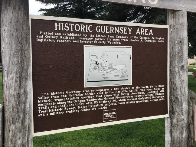
Platted and established by the Lincoln Land Company of the Chicago, Burlington and Quincy Railroad, Guernsey garners its name from Charles A. Guernsey, noted legislator, rancher, and investor in early Wyoming.
The historic Guernsey area encompasses a key stretch of the North Platte River Valley from the Nebraska border west to the Hartville Uplift. The river forms an historic transportation corridor that began with the Native Americans, continued with emigrants along the Oregon/California/Mormon Pioneer/Pony Express National Historic Trails and continues today with US Highway 26, which has been designated the Oregon Trail Historic Byway. Major irrigation projects, large mining operations, a state park, and a military training center are nearby.
The Natchez Trace Parkway is a 444-mile drive that stretches through Mississippi, Alabama and Tennessee – linking Nashville, TN, to Natchez, MS. The current roadway mainly follows the path of the Old Natchez Trace, which was a combination of a wilderness road, horse trail and foot path. One of most frequently used sections of the trail was known as Natchez or Chickasaw Trail.
It was regularly used throughout the late 1700s and early 1800s as a commercial road between the East and the Southwest and Mississippi River, but it had been animal and Native American trail for thousands of years. The original wilderness road ran through Old Town, MS, which was an area settled due to the abundance of bison and water. This section is known as the Old Natchez Trace.
Due the difficulty of navigating the Natchez Trace, in 1800, the U.S. Congress created legislation to create a major road that would allow for easier travel between Nashville and Natchez. “The Government Road” was completed in 1802, and this road linked Nashville with the original Trace.
Historical Marker Inscription
Two portions of a nearly 200 year old wilderness road, the Old Natchez Trace, are preserved here. Nearly 500 miles long, it grew from Indian trails to a national road and communications link between the Old Southwest and the United States to the northeast.
A short 5-minute loop walk to your left lets you see both sections and lets you stroll down a steeply eroded, sunken part of the Old Natchez Trace.
Location
Natchez Trace Parkway, Ridgeland, MS 39157, United States
Known as the “The Great Pathfinder”, John Charles Frémont was born in Savannah, Georgia, on January 21, 1813, and he was one of only two native Georgians that fought for the U.S. Army during the Civil War. During the years before the war, Frémont led several exploratory expeditions into the West. His goal was to create surveys and maps for the U.S. westward expansion.
During 1838 to 1839, he assisted Joseph Nicollet, a well-known scientist, in surveying the Upper Mississippi and Missouri Rivers. Frémont became famous for his campaigns into the west during the 1840s, including one that involved crossing the Sierra Nevada during the winter. He was instrumental in securing California for the U.S. during the Mexican-American War, capturing the cities of Presidio, Santa Barbara and sections of Los Angeles.
Frémont was fortunate to strike gold during the California gold rush and was a California senator from 1850 to 1851. He unsuccessfully ran for president of the U.S. in 1856, becoming the first Republican Party candidate.
One of two native Georgians who served as generals in the U.S. Army during the Civil War, John C. Frémont was born nearby on January 21, 1813. As an army officer, his 1840s explorations of the American West gained him fame as the “Pathfinder.” During the U.S.-Mexican War, Frémont seized California for the U.S. and was elected one of its first Senators in 1850. Opposed to slavery’s expansion, he ran unsuccessfully in 1856 as the first Republican presidential candidate. During the Civil War, Frémont’s 1861 proclamation freeing all Confederate-owned slaves in Missouri was annulled by President Lincoln. After lackluster performance as a combat commander, Frémont resigned from the U.S. Army in 1864. He later served as governor of the Arizona Territory (1878-1881) and died in New York in 1890.
Erected for the Civil War 150 commemoration by the Georgia Historical Society, the Georgia Department of Economic Development, and the Georgia Battlefields Association
While most burial mounds in Mississippi are dated to around 100 B.C. to 400 B.C. (the Middle Woodland period), the six burial mounds at Boyd Site date to around 800 to 1100 A.D. (the Late Woodland and Early Mississippian periods).
In 1964, the National Park Service excavated some of the mounds. One of the mounds appears to be 100 feet long, but is actually 3 different mounds. Within these 3 mounds, 41 burials were found.
While few artifacts were discovered within burial sites, the pottery that was discovered possibly indicate that the mounds were created in two different phases: one within the Late Woodland period and another within the Mississippian period.
Historical Marker Inscription
Archaeologists tell us that there was a house here sometime around 500 A.D. and that the pottery found in the mounds was made before 700 A.D. Likely, the population was continuous over centuries with customs being handed from generation to generation, relying on field, forest, and stream for food. The simple social system was probably based on family and close relatives.
United States Department of the Interior
National Park Service
Location
The mounds are located approximately 6 miles from I-55 on the Natchez Trace Parkway, Madison, MS 39110
Known as the “Singing Brakeman” and “America’s Blue Yodeler”, James Charles Rodgers, better known as Jimmie Rodgers, was a pioneering country music star. He has been regarded as the Father of Country Music, combining elements from different genres, including jazz, folk music and work chants.
Born on September 8, 1987, the son of a railroad section foreman, Jimmie was attracted to music from a young age. At 13, he won an amateur talent show and soon after ran away to join a traveling medicine show. His father found him and brought Rodgers back to work on the railroad. During the early 1900s, he worked as everything from a call boy to a brakeman to a baggage master.
In 1924, he developed tuberculosis – a disease that would plague him throughout his life and lead to his death – he abandoned railroad work and devoted himself to music. He wouldn’t, however, find success until 1927 working a regular, unpaid spot on an Asheville, North Carolina, radio station.
His luck turned again, when he learned that Ralph Peer, an agent for Victor Talking Machine Company, was doing field recordings. There was a positive response to his release, and he wound up recording again for Peer, leading to the release of “Blue Yodel (T for Texas), which became his first big hit.
Rodgers would spend the next five years traveling across the nation, appearing in a movie and recording with famous stars, including the Carter Family, Bill Boyd and Louis Armstrong.
Jimmie Rodgers (1897 – 1933) is widely known as the “father of country music,” but blues was a prominent element of his music. The influence of his famous “blue yodels” can be heard in the music of Mississippi blues artists including Howlin’ Wolf, Mississippi John Hurt, Tommy Johnson, and the Mississippi Sheiks. His many songs include the autobiographical “T.B. Blues,” which addressed the tuberculosis that eventually took his life.
Side B
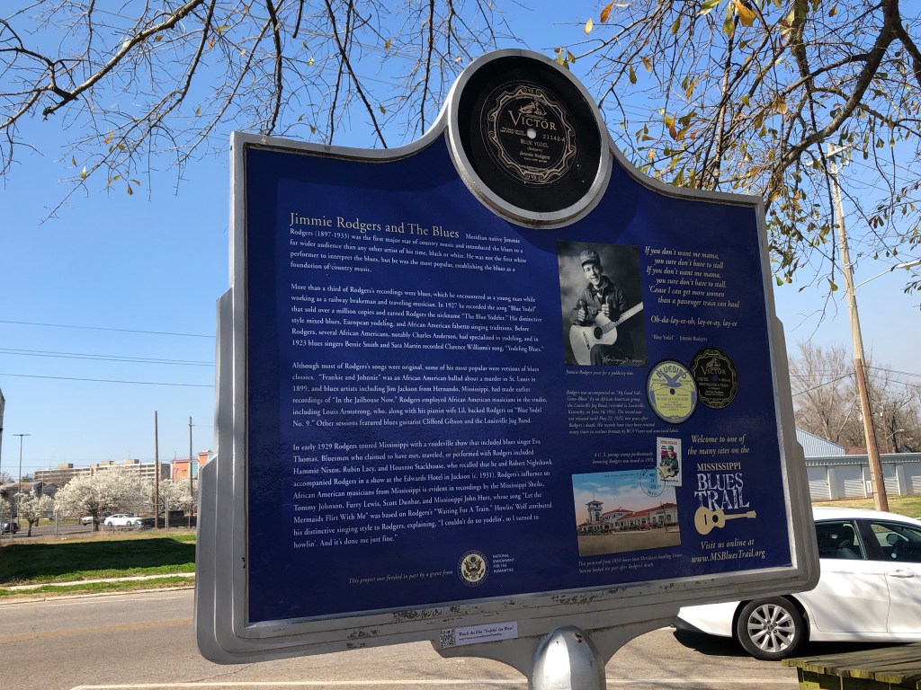
Jimmie Rodgers and The Blues Meridian native Jimmie Rodgers (1897-1933) was the first major star of country music and introduced the blues to a far wider audience than any other artist of his time, black or white. He was not the first white performer to interpret the blues, but he was the most popular, establishing the blues as a foundation of country music.
More than a third of Rodgers’s recordings were blues, which he encountered as a young man while working as a railway brakeman and traveling musician. In 1927 he recorded the song “Blue Yodel” that sold over a million copies and earned Rodgers the nickname “The Blue Yodeler.” His distinctive style mixed blues, European yodeling, and African American falsetto singing traditions. Before Rodgers, several African Americans, notably Charles Anderson, had specialized in yodeling, and in 1923 blues singers Bessie Smith and Sara Martin recorded Clarence Williams’s song, “Yodeling Blues.”
Although most of Rodgers’s songs were original, some of his most popular were versions of blues classics. “Frankie and Johnnie” was an African American ballad about a murder in St. Louis in 1899, and blues artists including Jim Jackson from Hernando, Mississippi, had made earlier recordings of “In the Jailhouse Now.” Rodgers employed African American musicians in the studio, including Louis Armstrong, who, along with his pianist wife Lil, backed Rodgers on “Blue Yodel No. 9.” Other sessions featured blues guitarist Clifford Gibson and the Louisville Jug Band.
In early 1929 Rodgers toured Mississippi with a vaudeville show that included blues singer Eva Thomas. Bluesmen who claimed to have met, traveled, or performed with Rodgers included Hammie Nixon, Rubin Lacy, and Houston Stackhouse, who recalled that he and Robert Nighthawk accompanied Rodgers in a show at the Edwards Hotel in Jackson (c. 1931). Rodgers’s influence on African American musicians from Mississippi is evident in recordings by the Mississippi Sheiks, Tommy Johnson, Furry Lewis, Scott Dunbar, and Mississippi John Hurt, whose song “Let the Mermaids Flirt With Me” was based on Rodgers’s “Waiting For A Train.” Howlin’ Wolf attributed his distinctive singing style to Rodgers, explaining, “I couldn’t do no yodelin’, so I turned to howlin’. And it’s done me just fine.”
If you don’t want me mama, you sure don’t have to stall If you don’t want me mama, you sure don’t have to stall. ‘Cause I can get more women than a passenger train can haul
Daniel H. Burnham was a prominent architect during the late 1800s and early 1900s. He helped rebuild Chicago after the Great Chicago Fire of 1871. As part of the City Beautiful reform, which was a movement against overpopulation and poverty, the city approved the Group Plan of 1903 to build a mall that would work as Cleveland’s main center. Daniel Burnham helped design the Group Plan for Cleveland.
In August 1903, architects Daniel H. Burnham, John M. Carrére, and Arnold W. Brunner presented Mayor Tom L. Johnson and the City of Cleveland a plan that epitomized the City Beautiful Movement in America. The Group Plan envisioned a grand landscaped mall surrounded by public buildings in the Beaux-Arts style. The plan would create a monumental civic center, influence the design of buildings throughout the city, and lay the foundation for a city planning commission. The first of its kind in the nation, the Group Plan, as built, was the most completely realized of Burnham’s city planning efforts. In its green space and architecture, the Mall remains an enduring and vital element of Cleveland’s civic culture.
Side B
“Make no little plans. They have no magic to stir men’s blood and probably themselves will not be realized. Make big plans; aim high in hope and work, remembering that a noble, logical diagram once recorded will never die, but long after we are gone will be a living thing, asserting itself with ever-growing insistency.”
The Belhaven Historic District is located in a hilly area of Jackson, Mississippi. The district includes Belhaven University and the Eudora Welty House. The area is distinct due to its many different architectural styles, including Queen Anne, Greek Revival and Neoclassical Revival. This is why this neighborhood is considered one of the most architecturally diverse areas in the country.
Named after the house of a Confederate veteran of the Civil War, Jones S. Hamilton, the Belhaven Neighborhood is one of the oldest neighborhoods in Jackson. The name Belhaven was given to the home in honor of Hamilton’s ancestral home in Scotland. Before that, in 1875, the area was known as Moody Estate. By the early 1900s, North State Street was considered to be one of the most fashionable places to live with its large homes.
In 1983, the neighborhood was listed on the National Register of Historic Places.
Historical Marker Inscription
The Belhaven neighborhood developed north of the city as Jackson’s first suburb. Composed of more than 1,300 historic structures dating from as early as 1904, Belhaven is Mississippi’s largest historic district. The neighborhood includes a wide variety of building styles with a mixture of commercial and residential developments, as well as religious and educational institutions.
The Belhaven Historic District is listed in the National Register of Historic Places.
Location
Intersection of Riverside Drive and Peachtree Street, Jackson, MS
During the 1800s, the “castle look” was a popular architectural style in New Orleans. These Gothic references to the Old World were found in Carollton, Harvey, Algiers, Gretna and the Third District. The Harvey Castle was one of the most recognizable versions of this style.
Built on the Destrehan Canal in 1846, it was the home of Louise Destrehan and Captain Joseph Hale Harvey. The Destrehan Canal was owned by Nicholas Noel Destrehan.
According to historical references by a descendant, the castle was “medieval, two turreted baronial castle patterned from a faded old picture of grandfather’s and great uncle’s home in Scotland”.
Later, the Destrehan Canal became the Harvey Canal. The castle was then converted into the Jefferson Parish Courthouse (from 1874 to 1884). In 1920, it was demolished to expand the Harvey Canal when it became part of the Gulf Intracoastal Waterway.
Historical Marker Inscription
Built in 1844, Harvey Castle was the Gothic Revival home of Marie Louise Destrehan and her husband Joseph Hale Harvey. It served as the third courthouse of Jefferson Parish, 1874-1884. Located east side of Destrehan Avenue 450 feet north of railroad. Demolished in 1924 to enlarge Harvey Canal and Locks.
Sandusky, Ohio, was active in the Underground Railroad both before and during the Civil War. The Underground Railroad was a network of people who aiding in helping escaped enslaved people get to freedom. These people often provided food, shelter and transportation.
Ohio’s southern river boundary was over 450 miles long, creating an extremely long border between the anti-slavery State of Ohio and slave-holding areas of Virginia and Kentucky. If slaves were able to cross the Ohio River, then they could be funneled to cities like Sandusky or Cleveland, or even escape to Canada since slavery had been outlawed in Great Britain since 1833.
Many of the residents of Sandusky were anti-slavery since a good portion of the people who lived there had come from New England and often sympathized with the slaves. Ohio’s railway lines helped bring freedom-seekers to Sandusky, where they could escape aboard vessels.
Sandusky actually played a major role in Harriet Beecher Stowe’s Uncle Tom’s Cabin since it was many times the final stop to freedom.
Historical Marker Inscription
Many homes in Sandusky and other parts of Erie County were stations on the Underground Railroad before and during the Civil War. Residents provided food, shelter, clothing and transportation to Canada. Harriet Beecher Stowe used Sandusky as the gate to freedom for the run-away slaves in her book “Uncle Tom’s Cabin”.
Location
Jackson Street Pier, 233 West Shoreline Drive, Sandusky, Ohio 44879
Located in Lauderdale County in the East Central Hills of Mississippi, Meridian started in 1831 after the Choctaw Indians left the land as part of the terms of the Treaty of Dancing Rabbit Creek. The city got its name from a settler who believed that the word “meridian” actually meant “junction” or “zenith”.
Richard McLemore of Virginia was the first to come to area and then offered free land to others to try to get them to move the region. By 1855, railroads had linked Meridian with other areas, and, by the 1860s, there were 15 families living in the town.
Meridian played a role during the Civil War. It was the location of the Confederate arsenal, a stockade for prisoners and a military hospital, and it even was the location of the state capital for a month in 1863. In February 1864, Union General William Tecumseh Sherman destroyed the city. The only surviving antebellum mansion in the area from before this time is Merrehope, a Greek Revival home.
For a period of time during the 1890s until 1930, Meridian was also the largest manufacturer in the state. It was known for timber and cotton production.
Historical Marker Inscription
Formerly Sowashee, it was chartered 1860, and throve as rail junction during the Civil War, serving in 1863 as temporary capital and as depository of the state’s official records.