The Great Platte River Road was a travel corridor that ran alongside the Platte River in Nebraska and Wyoming. The road was nearly 800 miles and ran from the Second Fort Kearny to Fort Laramie.
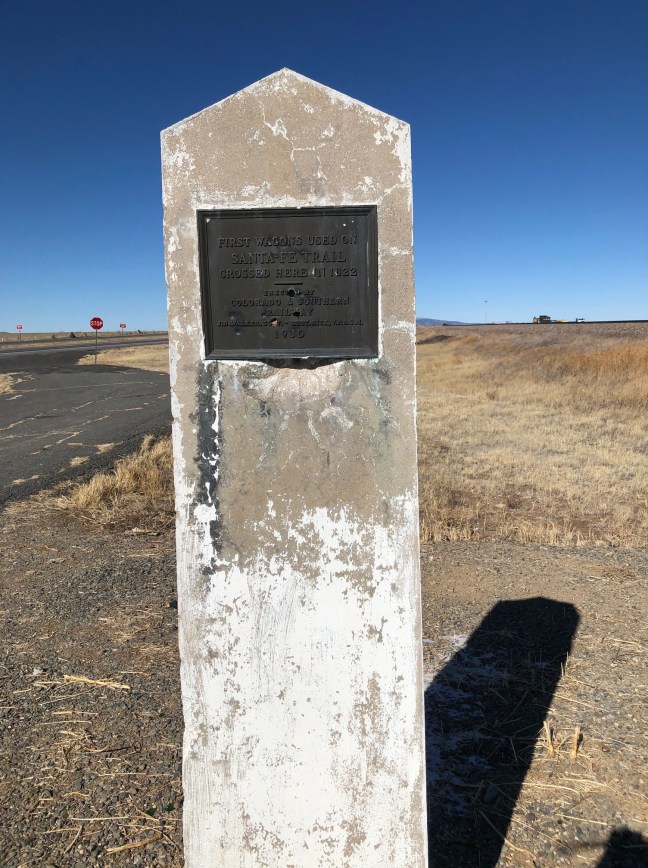
Known as the “grand corridor of America’s westward expansion” – or the Superhighway of the time – it was used from 1841 to 1866. The road was included in many other western routes, including the Mormon Trail, Trapper’s Trail, California Trail, Oregon Trail, Pony Express and military routes between Fort Laramie and Fort Leavenworth.
There is now a monument and museum dedicated to the people who took the Platte River path through Nebraska. It’s called the Great Plate River Road Archway Monument, and there is a fee to enter.
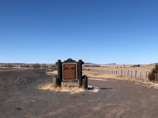
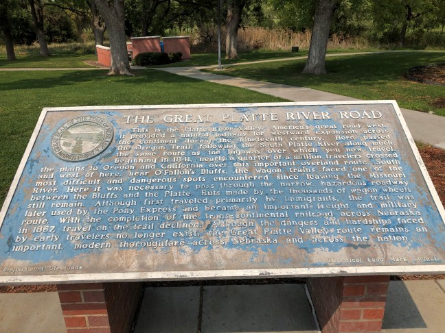
Historical Marker Inscription
This is the Platte River Valley, America’s great road west. It provided a natural pathway for westward expansion across the continent during the nineteenth century. Here passed the Oregon Trail, following the South Platte River along much the same route as the highway over which you now travel. Beginning in 1841, nearly 250,000 travelers crossed the plains to Oregon and California over this important overland route. Here at O’Fallon’s Bluffs, the wagon trains faced one of the most difficult and dangerous spots on the trail. The Platte River cut directly against the bluff, making it necessary to travel the narrow roadway over O’Fallon’s Bluffs. Deep sand caught the wagon wheels, and Indian attacks were always a danger. A few feet southeast of this point, ruts made by thousands of wagon wheels still remain. Although first traveled primarily by immigrants, the trail was later used by the Pony Express and became an important freight and military route. With the completion of the trans-continental railroad across Nebraska in 1867, travel on the trail declined. Although the dangers and hardships faced by early travelers no longer exist, the Great Platte Valley route remains an important modern thoroughfare across Nebraska and across the nation.
Location: Sutherland Westbound I-80 Rest Area, 5 miles west of Hershey, NE
41.141302, -101.090121