John B. “Texas Jack” Omohundro 1846-1880

As you’re entering Leadville on the south end of town on Highway 24, you’ll run into two historical markers: one is the main Leadville marker, and the second is dedicated to John B. “Texas Jack” Omohundro.

The History

Texas Jack lived from July 26, 1846 until June 28, 1880. He served as a Confederate soldier during the American Civil War and then later as a scout for the U.S. Army during the Indian Wars.

Texas Jack moved to Fort Hays, Kansas, in 1869. Here, he met both Wild Bill Hickok, famous gunfighter, gambler and showman, and California Joe Milner, who was a miner and frontier scout. Within the same year, he always become friends with William F. “Buffalo Bill” Cody, who was at Fort McPherson working with the 5th U.S. Cavalry.

By 1872, Cody and Texas Jack were appearing on stage together as part of the live show “Scouts of The Prairie”. In 1873, Wild Bill would join the show, which was renamed “Scouts of The Plains”. Throughout the 1870s, Texas Jack would be part of the theater.

Texas Jack died due to pneumonia on June 28, 1880 in Leadville, Colorado, about one month short of his 34th birthday. Unlike Hickok and Cody, he never became a household name.

To learn more about Texas Jack, check out the Buffalo Bill Center of the West site.

The Historical Marker

The inscription on the marker is as follows:

“Born in Virginia, Texas Jack came west after the Civil War at age 16 to become a cowboy. He later made a name for himself as a plainsman and U.S. government scout who led the Pawnee Indians on their summer hunts and was guide for such notables as the Earl of Dunraven.

In 1872, with friend W. F. (Buffalo Bill) Cody, he achieved national fame by starting the first wild west shows in America. (Texas Jack was honored posthumously in 1994 by induction into the National Cowboy Hall of Fame’s Hall of Great Western Performers located at Oklahoma City).

Jack and his lovely wife, the celebrated danseuse Mlle. Guiseppina Morlacchi resided in Leadville where on June 28. 1880 he died at age 33. He is buried in Leadville’s Evergreen Cemetery.”

Location: 39° 15.785′ N, 106° 17.459′
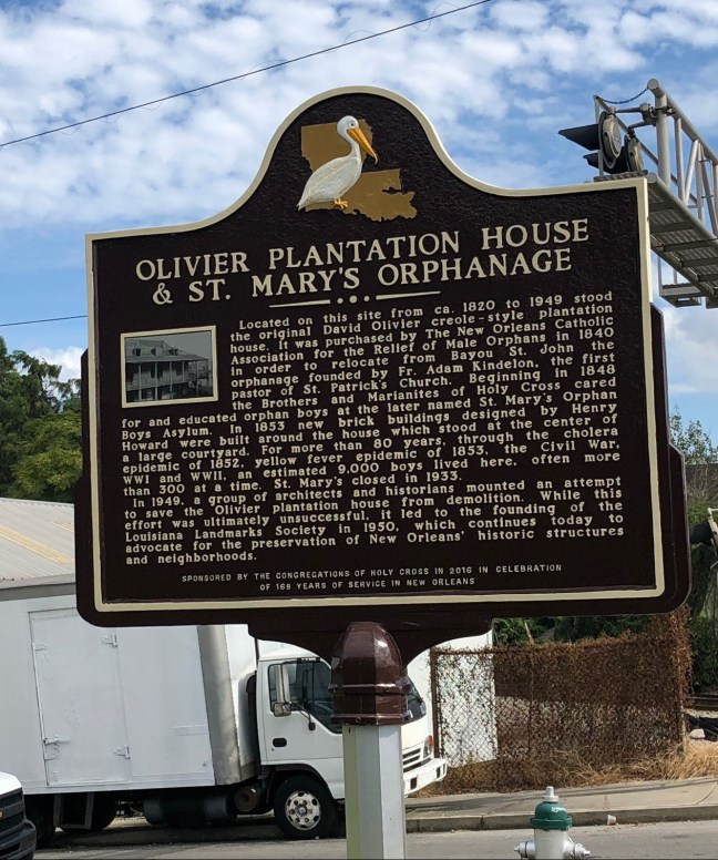
Olivier Plantation House & St. Mary’s Orphanage

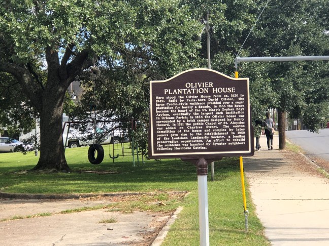
Olivier Plantation Historical Marker New Orleans

What is now an empty lot in the Bywater neighborhood of New Orleans used to be a plantation owned by Antoine David Olivier, who was born in Lyon, France in 1759. By the 1800s, he was living in America as a wealthy man. In the 1820s, he began building a lavish, West Indies-influenced, French Creole home near the Mississippi River. The house was part of an extensive plantation complex. In fact, the property was 2 arpents wide and 40 arpents deep. An arpent is an old French unit of land and is equivalent to about 1 acre. Olivier died in 1844, but the home had been sold before then.

In 1833, Etienne Carraby bought the place. It passed through several hands until Albert Piernas sold it right after the Civil War to the Sisters of the Order of the Holy Cross, which converted it into a boy’s orphanage.

During this time, the exterior buildings were torn down, including the kitchen, pigeonniers and stables. It became St. Mary’s Orphan Asylum, and a large dormitory wing was added to the house. The orphanage closed in the 1930s due to Huey P. Long placing most social services under the handling of the State of Louisiana. The building had begun to deteriorate, and it was eventually torn down in 1949.

Yet, there was some controversy to tearing this historical plantation down. A local historian tried to stop the demolition by talking to the contractor right before the bulldozer was set to tear it apart. The contractor and the leaseholders gave the historian a few weeks to try and save the property. He along with a few other interested parties tried everything from attempting to get a company to renovate the property to raising money.

When no plans worked, they instead worked to salvage some of the architecture, and some final pictures were taken. Yet, the simple act of tearing down an old building would create a coalition dedicated to preserving Louisiana historical places.

You can see pictures of the original building on this website. You can also read how the demolition of this plantation led to the creation of the Louisiana Landmarks Foundation in this article.

Olivier Plantation House & St. Mary's Orphanage Historical Marker

Inscriptions

One side: Here stood the Olivier House from ca. 1820 to 1949. Built by Paris-born David Olivier, the large Creole-style residence presided over a sugar cane plantation for barely a decade. In 1835 the house became heart of the St. Mary’s Orphan Boys Asylum, eventually the largest such institution in Orleans Parish. In 1854 the Olivier house was surrounded by a brick campus designed by Henry Howard. In 1891 the gothic Chapel of St. Aloysius was added on Chartres Street. The wanton demolition of the house and complex by later owners gave rise to the establishment in 1950 of the Louisiana Landmark Society, a leading preservation organization. An effort to rebuild the residence was launched by Bywater neighbors following Hurricane Katrina.

Other side: Located on this site from ca. 1820 to 1949 stood the original David Olivier creole-style plantation house. It was purchased by The New Orleans Catholic Association for the Relief of Male Orphans in 1840 in order to relocate from Bayou St. John the orphanage founded by Fr. Adam Kindelon, the first pastor of St. Patrick’s Church. Beginning in 1848 the Brothers and Marianites of Holy Cross cared for and educated orphan boys at the later named St. Mary’s Orphan Boys Asylum. In 1853 new brick buildings designed by Henry Howard were built around the house which stood at the center of a large courtyard. For more than 80 years, through the cholera epidemic of 1852, yellow fever epidemic of 1853, the Civil War, WWI and WWI, an estimated 9,000 boys lived here, often more than 300 at a time. St. Mary’s closed in 1933.

In 1949, a group of architects and historians mounted an attempt to save the Olivier plantation house from demolition. While this effort was ultimately unsuccessful, it led to the founding of the Louisiana Landmarks Society in 1950, which continues today to advocate for the preservation of New Orleans’ historic structures and neighborhoods.

Location: 29° 57.619′ N, 90° 2.145′ W

Intersection of Chartres Street and Mazant Street. 4111 Chartres Street, New Orleans, LA.

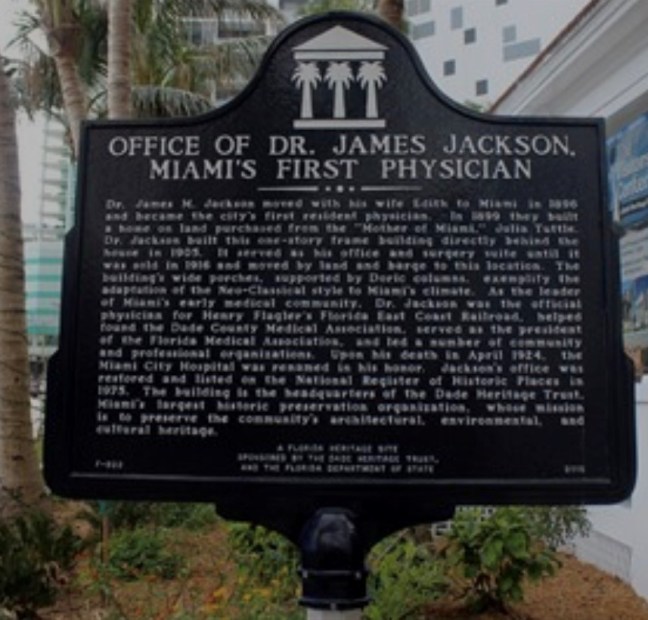
Dr. James M. Jackson – Miami’s First Physician

On a random corner in Miami, you’ll run into the historical marker that signifies the location of the site of Miami’s first resident physician: Dr. James M. Jackson. The location housed both his office and the surgery facility. The building was added to the U.S. National Register of Historical Places on February 24, 1975.

Historical Marker Description

Dr. James M. Jackson moved with his wife Edith to Miami in 1896 and became the city’s first resident physician. In 1899 they built a home on land purchased from the “Mother of Miami,” Julia Tuttle. Dr. Jackson built this one-story frame building directly behind the house in 1905. It served as his office and surgery suite until it was sold in 1916 and moved by land and barge to this location. The building’s wide porches, supported by Doric columns, exemplify the adaptation of the Neo-Classical style to Miami’s climate. As the leader of Miami’s early medical community, Dr. Jackson was the official physician for Henry Flagler’s Florida East Coast Railroad, helped found the Dade County Medical Association, served as the president of the Florida Medical Association, and led a number of community and professional organizations. Upon his death in April 1924, the Miami City Hospital was renamed in his honor. Jackson’s office was restored and listed on the National Register of Historic Places in 1975. The building is the headquarters of the Dade Heritage Trust, Miami’s largest historic preservation organization, whose mission is to preserve the community’s architectural, environmental, and cultural heritage.

Jackson is buried in the Miami City Cemetery (also on the National Register of Historic Places), which is located at 1800 Northeast 2nd Avenue.

Location: 190 Southeast 12th Terrace, Miami, FL

N 25° 45.680 W 080° 11.398

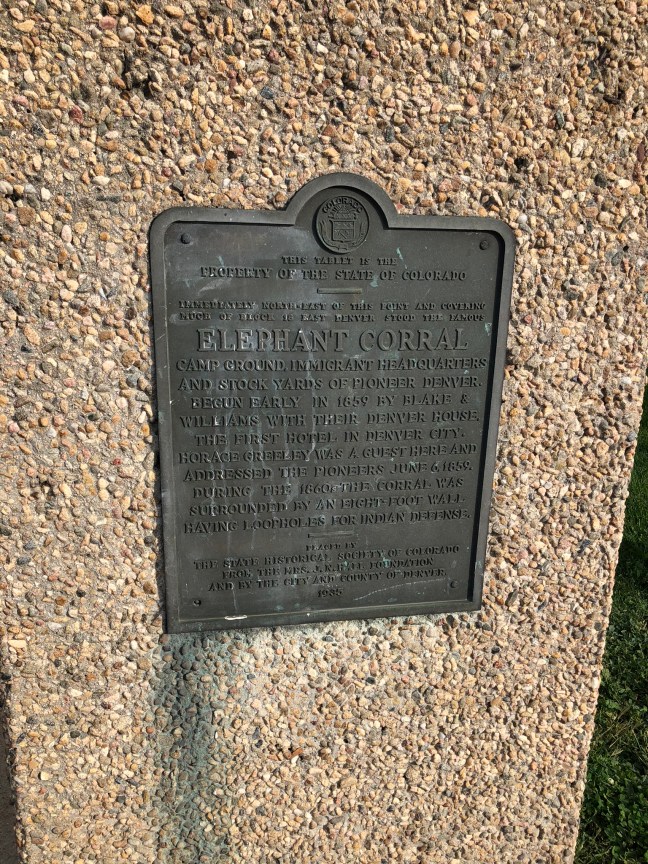
Elephant Corral, Denver, CO

While the origins of the name are murky, some people believe it comes from the old saying “Seeing the Elephant”, which was a gold rush slogan. Located in Lower Downtown (LoDo) Denver, this marker commemorates a hotel and stable for emigrant families and their animals (no elephants were recorded having been boarded here). It also functioned as a trading post, bar, stockyard and brothel.

People from around the world came to Denver trying to get rich off of gold, including people from the Northeast, Midwest and foreigners from around the world. And, these people needed a place to stay. The original proprietors were said to gather people up from the train station and bring them to the establishment.

Located in the Denver and Auraria settlement, the Elephant Corral was the largest building in the settlement at 32 feet wide and 100 feet long. Started by Charles Blake and Andrew Williams, they eventually sold it to Robert Teats, who made the property even larger and officially named it the Elephant Corral.

Historical Marker Text

Immediately north east of this point and covering much of Block 18 East Denver stood the famous Elephant Corral camp ground, immigrant headquarters and stock yards of pioneer Denver. Begun early in 1859 by Black & Williams with their Denver House, the first hotel in Denver City. Horace Greeley was a guest here and addressed the pioneers June 6, 1859. During the 1860s the corral was surrounded by an eight-foot wall having loopholes for Indian defense.

Location: 39.748597° N, 105.001822° W

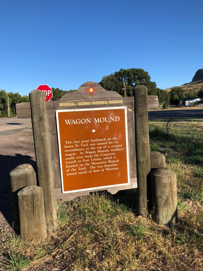
Wagon Mound, NM

For travelers along the long Santa Fe Trail, landmarks ensured that they were going in the right direction. One such landmark was the nearly 7,000-foot butte known as Wagon Mound, which was named due to its shape and the fact that it kind of looked like a covered wagon. It signaled the location of the Cimarron Cutoff, which was a settlement route that connected St. Louis, MO, and Santa Fe, NM.

Wagon Mound told travelers two things. It was the last major landmark before getting to Santa Fe and the end of their journeys. Two, it meant that there was a water source nearby in the Santa Clara Canyon. But, groups had to be careful in this area because there were hostile Native Americans in Santa Clara Canyon.

The route that took travelers near this landmark was popular from about 1822 to the 1870s.

Historical Marker Text

This last great landmark on the Santa Fe Trail was named for its resemblance to the top of a covered wagon. At Wagon Mound, travelers could cross from the Cimarron Cutoff to Fort Union, which is located on the Mountain Branch of the Trail. The two branches joined south of here at Watrous.

Location: 36° 0.697′ N, 104° 42.393′ W in Wagon Mound, NM, at the intersection of State Road 120 and I-25.

Jemez Mountains, NM

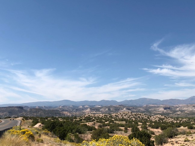
The Jemez Mountains are the remnants of a super volcano, whose last major eruption was about 1 millions years ago. Fewer, smaller eruptions have occurred since this last catastrophic one. While these mountains sit within the Rocky Mountains, they are geologically distinct from this mountain range.

IMG_3798

Many of the area points of interest, including Bandelier National Monument, are located on top of the ash flow from this volcano. You can also see the 13-mile wide circular depression created by the volcano at Valles Caldera National Preserve.

Text From the Historical Marker

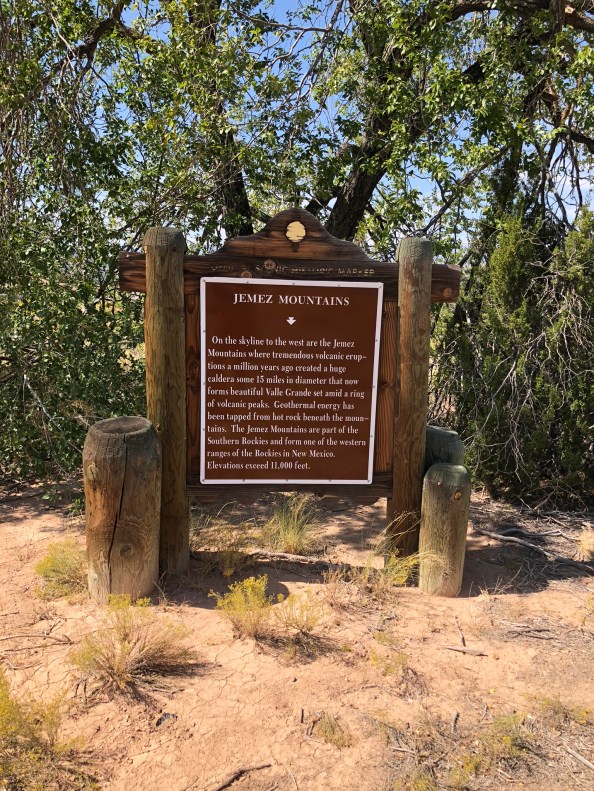
IMG_3799

Side 1: On the skyline to the west are the Jémez Mountains where tremendous volcanic eruptions a million years ago created a huge caldera some 15 miles in
diameter that now forms beautiful Valle Grande set amid a ring of volcanic peaks. Geothermal energy has been tapped from hot rock beneath the
mountains. The Jemez Mountains are part of the Southern Rockies and form one of the western ranges of the Rockies in New Mexico. Elevations exceed 11,000
feet.

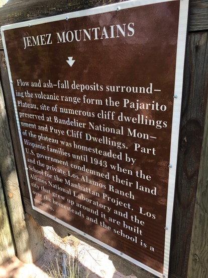
Side 2: Flow and ash-fall deposits surrounding the volcanic range form the Pajarito Plateau, site of numerous ancient cliff dwellings preserved at Bandelier National Monument and Puye Cliff Dwellings. Part of the plateau was homesteaded by Hispanic families until 1943 when the U.S. government condemned their land and the private Los Alamos Ranch School for the Manhattan Project. Los Alamos National Laboratory and the city that grew up around it are built over the homesteads and the school is a museum.

Location: Off Highway 502 in Santa Fe County between Santa Fe and Los Alamos. Latitude: 35.885887 N Longitude: 106.102225 W

New Mexico Highlands University

Located in Las Vegas, NM, New Mexico Highlands University was established by the Territorial Legislature in 1893 as the New Mexico Normal School. With the region booming due to the arrival of the Santa Fe Railroad in the 1870s, the area decided that it needed an institution of higher learning. It officially opened in 1898, and archaeologist Edgar Lee Hewett was the school’s first president.

What started as a school of 92 students and 6 faculty members quickly grew into a larger institution. Enrollment increased to over 300 in 1901. It’s name changed in 1902 to New Mexico Normal University and then again to New Mexico Highlands University in 1941.

By 1917, the school was offering four-year teacher training programs.

IMG_3894

New Mexico Highlands University Today

Today, the school has nearly 4,000 students, mainly from New Mexico and of Latino descent. The school is known for its multi-ethnic student body and offers programs in business, education, arts and sciences, and social work.

Location: 1005 Diamond St, Las Vegas, NM 87701 35.5933° N, 105.2223° W

The Greatest Ride in History

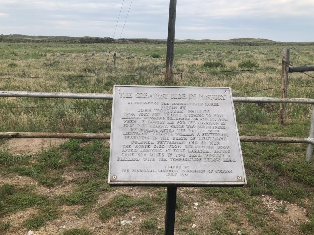
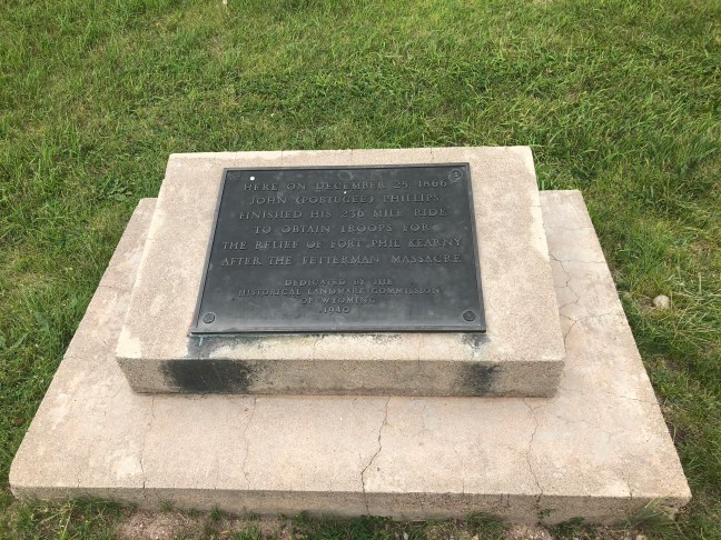
Wyoming Historical Marker Near Fort Laramie: Greatest Ride in History

Right outside of Fort Laramie is a historical marker commemorating a horse. While that might sound odd to many people, it’s actually one of the more interesting stories of Fort Laramie and Fort Kearny.

Background to the Ride

Fort Laramie had been the main outpost of the U.S. Government on the Northern Plains. For many years, it was the main meeting point between the government and the sovereign tribes of the Northern Plains, and many treaties had been signed there, including the Fort Laramie Treaty of 1851, which designated the territory near the fort as Crow land (west of the Powder River).

While the Lakota, Cheyenne and Arapaho had initially accepted the agreement, as the buffalo herds became reduced, they soon began invading Crow land. By 1860, these three tribes had taken over this land.

In June 1866, United States Colonel Henry B. Carrington left Fort Laramie and moved into the area now controlled by these three tribes. He was charged with protecting civilians traveling along the Bozeman Trail. Along this trail, he established Fort Phil Kearny and two other posts.

As the new fort was being constructed, conflict rose between the Native American warriors and the army. On November 3, 1866, a group of cavalry showed up at the fort to reinforce the post. They were led by Lieutenant Horatio S. Bingham and Captains William J. Fetterman and James W. Powell. Carrington had refused to take the offensive, which led to Fetterman criticizing him.

Carrington was eventually forced to take the offensive on November 25, 1866 when his superior ordered him to do it. On December 6, Carrington took the fight to the Native Americans, but suffered great losses, including the death of Bingham. Sobered by this, Carrington became more cautious. The Natives led by Red Cloud, the Oglala Lakota leader, had used a decoy to draw the army into a trap.

Fight on December 21, 1866

Encouraged by their success, Red Cloud decided to attack Fort Kearny. Sent to get timber and firewood for the fort, a wagon train was in an area about five miles away. The Native Americans attacked the train, and Carrington ordered soldiers to help fend off the attack. While Powell was initially in charge, Fetterman claimed seniority and took the lead.

Carrington had told the party not to pursue the Native warriors over the ridge. Fetterman ignored the command and chased the Native Americans over Lodge Trail Ridge. The Fetterman’s and 80 of his men’s bodies were later found mutilated. Wagons were sent to retrieve the bodies.

The Ride of a Lifetime

Because of Fetterman’s folly, more than one-quarter of the fort’s fighting men had died. The garrison was low on quality rifles and ammunition. There were still thousands of warriors in the area.

Carrington asked for civilian volunteers to ride out and ask for reinforcements. John “Portugee” Phillips agreed to do the ride. In the bitterly cold, blizzard-laden night, Phillips took the commanding officer’s own horse and rode out into the night. He arrived at the Fort Laramie parade ground on Christmas night during a full-dress garrison ball.

The Spot Where John "Portugee" Phillips Arrived at Fort Laramie

He quickly told the story of the Fetterman massacre and how Fort Kearny needed their help. Phillips horse died from exhaustion shortly after arriving at Fort Laramie. It had gone 236 miles in two days in a blizzard and freezing conditions.

Site of Santa Fe’s First Chapel

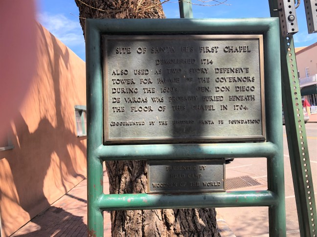
Santa Fe, New Mexico Historical Marker: First Chapel

Santa Fe is a mecca of history, so there are plenty of historical markers in the area. On the southeast corner of the Place of the Governors lies the historical marker for Santa Fe’s first chapel.

According to the marker, the chapel was “Also used as two story defensive tower for Palace of the Governors during the 1600’s. Gen. Don Diego de Vargas was probably buried beneath the floor of this chapel in 1704”. The chapel was demolished in 1774.

Don Diego de Vargas

Diego de Vargas Zapata y Luján Ponce de León y Contreras, better known as Don Diego de Vargas, was a Spanish Governor of the territory of Santa Fe from most of the 1690s until 1704. He was in charge of the reconquest of the New Mexico territory after the Pueblo Revolt in 1692.

The Pueblo Revolt started in August 1680, and involved Pueblo people from different pueblos. While traditional extremely peaceful people, the Pueblo people were treated cruelly by the Spanish rulers. They overthrew Spanish rule in New Mexico and held the area for more than 12 years.

Location: N 35° 41.261 W 105° 56.266

Dominguez Y Escalante Expedition 1776 – 1976

Located in Marble Canyon on Highway U.S. 89A at mile post 557, this spot commemorates a portion of the Dominguez y Escalante Expedition. While the marker itself is missing, you can see the stone holder of where it used to be.

Father Silvestre Velez Escalante and Father Francisco Atanasio Dominguez were co-leaders of an expedition, along with 10 companions, that left Santa Fe, NM, to try and a find a route to Monterey, CA. The Dominguez-Escalante Expedition began in July 1776, but was having trouble less than 10 weeks after leaving Santa Fe.

Near Thermo Hot Springs in Utah, they ran into a blizzard, and supplies were running short. The members of the crew drew lots to determine whether they should try to continue forward or turn back to Santa Fe. The outcome was that they turned around and were back in Santa Fe on January 2, 1777.

Dominguez-Escalante Expedition Historical Marker

Located near the Vermillion Cliffs, according to the Historical Marker Database, this marker memoralizes the following:

Within sight of this place the Franciscan priests Dominguez and Escalante and their ten companions experienced two of the most difficult challenges among many along the 1,800 miles of their epic journey from the Spanish presidio at Santa Fe, New Mexico.

IMG_0745